


News Archive
Quick Links
- Resilience Program
- Resilience Program
- Resilience Program
- WWoW Christmas Decorations Winners
- Resilience Program
- Resilience Program
- Resilience Program
- Resilience Program
- Resilience Program
- Resilience Program
- Resilience Program
- Bushfire Season 2018-19
- Bushfire Season 2016-17
- WWoW Christmas Letterbox Decoration Winners
- Pile Burn Advisory
- Bushfire Season 2014-15
- DSMRA’s Kowen Forest Ride
- DSMRA’s Kowen Forest Ride
- Fox Baiting
- WWoW Christmas Letterbox Decoration Winners
- WWoW Christmas Letterbox Decoration Finalists
- Bushfire Season 2013-14
- MRR Progress
- MRR Progress
- MRR Progress
- MRR Progress
- MRR Progress
- MRR Progress
- MRR Works Begin
- MRR
- Draft PLEP
- Pile Burn Advisory
- Mayoral Election
- Telstra Mobile Tower
- Hall Kitchen
- Telstra Mobile Tower
- Fire Season Starts Early for Wamboin
- Land for Wildlife
- Rainy Weather
- 2010 Wombat Calendar
- Yass Rail Bridgework Opens
- Rail Bridge on Track
- Yass Road Heavy Lifting
- Bridge Building - ikea style
- Work Begins on Bridge Replacement
- Closure of Yass Road
- Library Development Grant
- Add News Item
 top
top top
top
The BUILDING COMMUNITY RESILIENCE PROGRAM is about improving resilience against future natural disasters by extending and expanding the reach of the social connections in our community. We do this by:
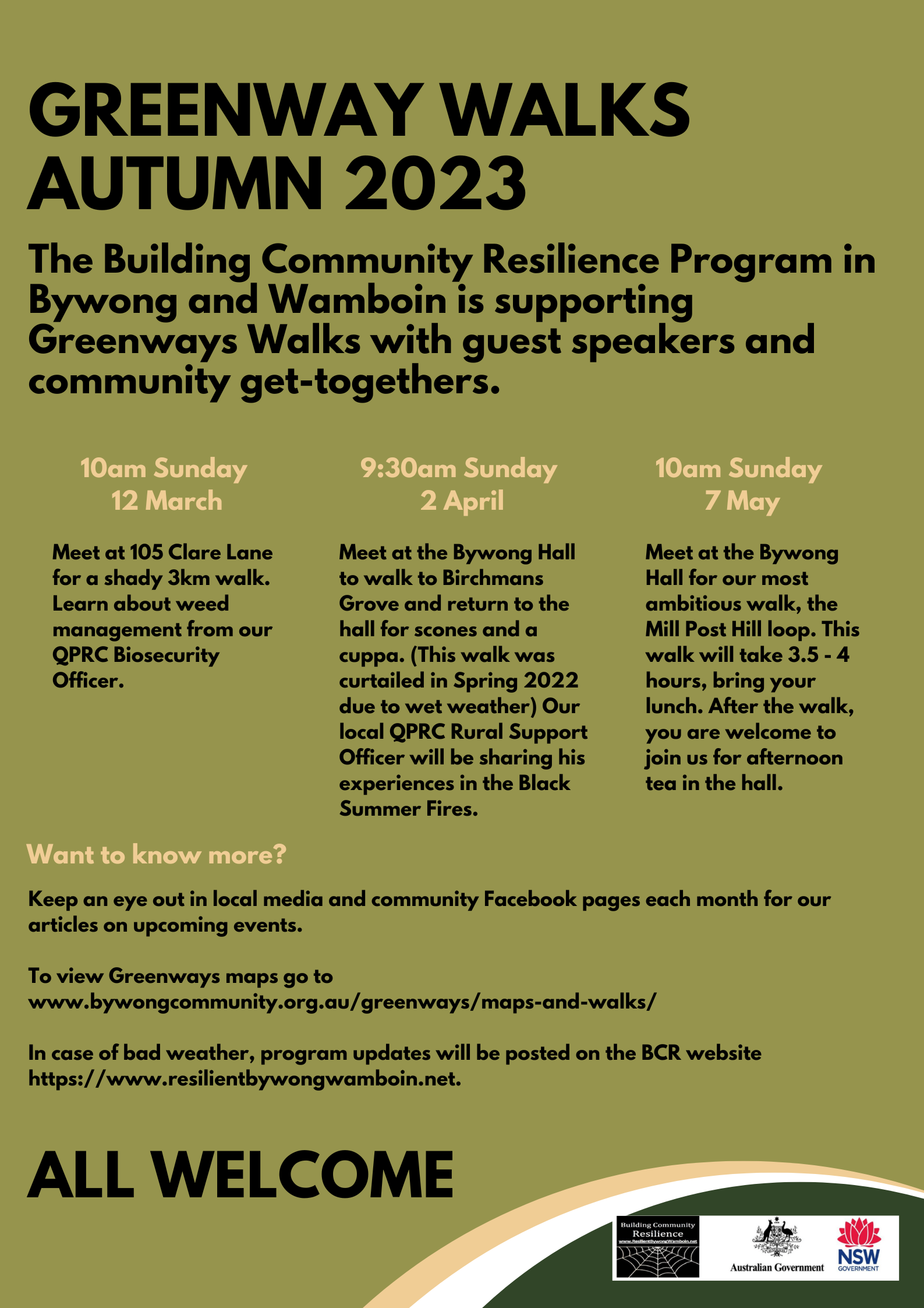
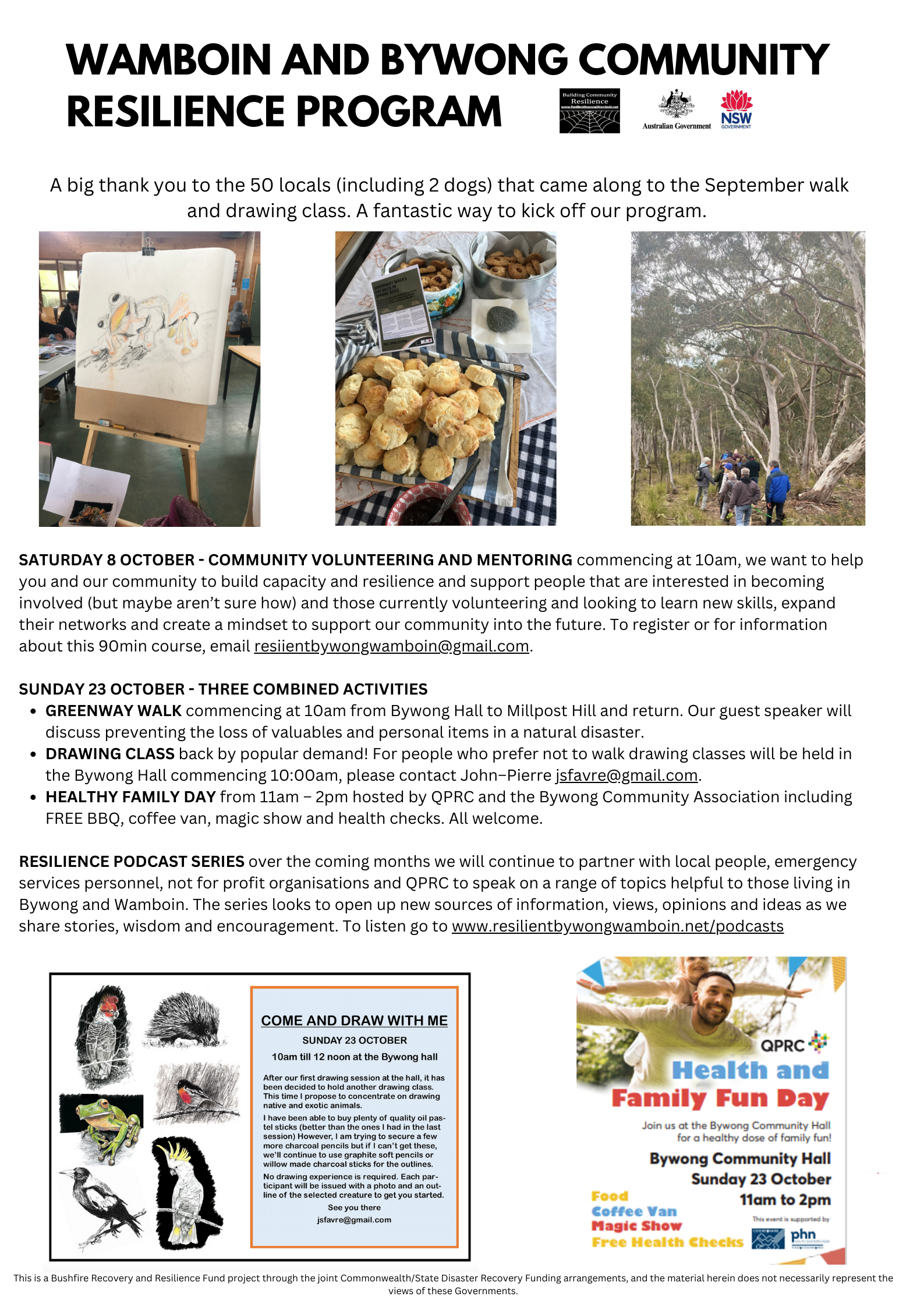
To join our mailing list please register your interest at https://www.resilientbywongwamboin.net/join. Did you know that the Building Community Resilience program is run by locals for locals, and so far, around 170 LOCALS RANGING IN AGE FROM 10 - 80 have come along to events hosted or supported by the BCR program? A big THANK YOU to everyone that has joined us. The BCR Program was setup by locals for locals, including people like Nora Stewart who was instrumental in securing grant funding for the program and Robyn Neilsen and the volunteer steering group who bring ideas and direction to ensure the program continues to meet our needs. The RESILIENCE PODCAST SERIES was started by the BCR program and that now has seven recordings featuring local people, emergency services personnel, not for profit organisations, and QPRC representatives speaking on a range of topics helpful to those living in Bywong and Wamboin. The series looks to open up new sources of information, views, opinions and ideas as we share stories, wisdom and encouragement. To listen go to https://www.resilientbywongwamboin.net/podcasts. Planning for AUTUMN GREENWAY WALKS is underway with walks to take place March - May. These will be advertised in local media, FaceBook pages and on community notice boards in the week leading up to the walks. If you have come along to a walk in the past please bring a friend or neighbour along next time. Safe holidays everyone, looking forward to catching up next year. |

19 December 2022
WWoW Christmas Decoration Competition
Once again the community mailbox and entrance decorating contest brought out our communal creativity. It’s good to see a bit of special holiday fun as we drive around.
The Best Mailbox prize went to 164 Bingley Way.

The Best Entrance prize went to 916 Mac Reef Road.

A big thank you to everyone who participated and helped to make Christmas a merry affair in Wamboin and Bywong.
top
|
BYWONG and WAMBOIN
|
| Sunday 18 September |
Sunday 23 October |
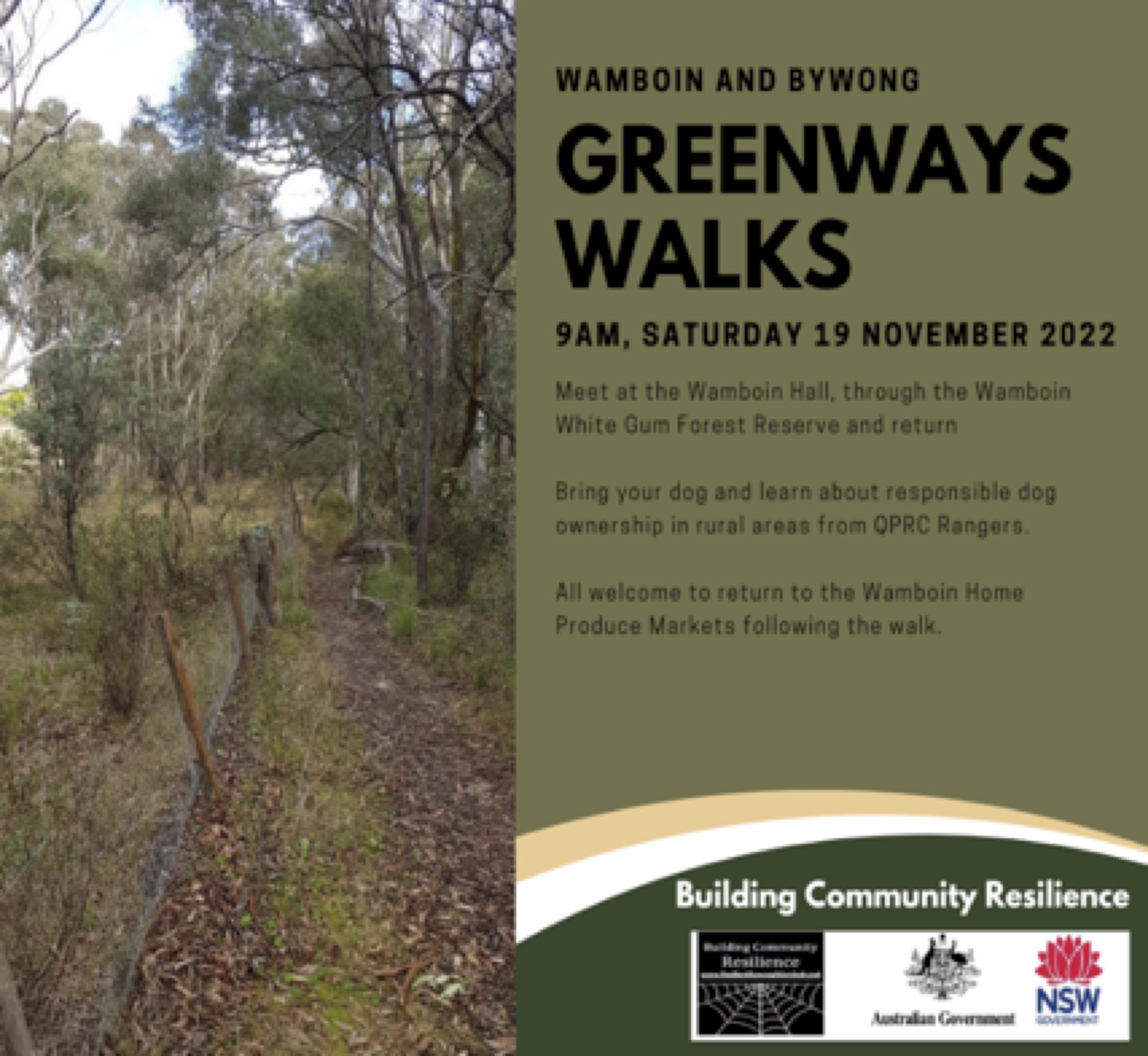
Sunday 19 November |
|---|---|---|
| Guest speakers will discuss birds in our local area and caring for injured wildlife. | Preventing loss of valuables and personal items in a disaster. | Bring your dog and learn about responsible dog ownership in rural areas. |
|
Commencing at 10am from the Bywong Hall along Greenway 1, through Birchmans Grove to the dam on Birchmans Creek and return to the hall for scones and a cuppa!
For people who prefer not to walk drawing classes will be held in the hall. Please contact John-Pierre jsfavre@gmail.com. Max 15 people. |
Commencing at 10am from the Bywong Hall to Millpost Hill along Greenways 1,3 and 4 and return.
Bywong Community Association will host a FREE BBQ lunch. All welcome. |
Meeting at 9am at the Wamboin Hall, we will then drive along Bingley Way, and park opposite lot no. 241. From there we will walk, with dogs on leads through the Wamboin White Gum Forest Reserve.
All welcome to return to the Wamboin Home Produce Markets following the walk. |
Want to know more?
Keep an eye out in local media and community Facebook pages each month for our articles on upcoming events.
To view Greenways maps go to https://www.bywongcommunity.org.au/greenways/maps-and-walks/ and https://kowen-trail-run.com/greenways/.
 top
top
Greenway Walk and Drawing ClassesOn Sunday 18 September at 10am we will be hosting a Greenway Walk from Bywong Hall to Birchmans Grove and return. Guest speakers will discuss birds in our local area and caring for injured wildlife. For people who prefer not to walk drawing classes will be held in the hall, please contact John–Pierre (). All welcome to come along to the hall for a cuppa and a scone. Community Volunteering and MentoringVolunteering can make a difference in your life and the lives of others. BCR are hosting a FREE community volunteering and mentoring program in early October. We want to help you and our community to build capacity and resilience and support people that are interested in becoming involved (but maybe aren’t sure how) and those currently volunteering and looking to learn new skills, expand their networks and create a mindset to support our community into a resilient future. To register or for course information email or go to https://www.resilientbywongwamboin.net/join. Resilience Podcast SeriesOver the coming months we will be partnering with local people, emergency services personnel, not for profit organisations and QPRC to speak on a range of topics helpful to those living in Bywong and Wamboin. The series looks to open up new sources of information, views, opinions and ideas as we share stories, wisdom and encouragement. To listen to existing and future podcasts go to https://www.resilientbywongwamboin.net/podcasts. |
DO YOU KNOW THAT IN AN EMERGENCY for safe access and egress to properties, Rural Fire Service Fire tankers need:
Firefighters will not access a property unless they know that they can also safely EXIT! COMMUNITY FIREWISE GROUPS (established in 2012) are a community resilience activity in the Bywong and Wamboin region for local people who want to access:
COMMUNITY FIREWISE GROUP COVENORS play an important role bringing together small, localised groups of residents to improve resilience to fire in their local area. Conveners don’t need firefighting qualifications or experience only a willingness to focus local fire prevention and preparedness activities and foster community connection. If you would like to learn more about becoming a Community FireWise Group Convener please contact wamboinsec@gmail.com or visit the Wamboin Rural Fire Brigade table at the Wamboin markets. The BUILDING COMMUNITY RESILIENCE PROGRAM are also inviting people who are interested in volunteering opportunities to participate in the free STEP UP AND STEP OUT program. We want to help you and our community to build capacity and resilience through facilitated small group discussions and mentoring to build confidence and develop practical strategies for working in, communicating with and managing a group. You can register your interest at www.resilientbywongwamboin.net/join. |
The Bywong and Wamboin Community Resilience Program will be running a FREE community leadership and mentoring program to support people that are interested in helping out in their community (but maybe weren’t sure how) and those currently volunteering and looking to learn new skills. Volunteering can make a difference in your life and the lives of others. Our region is home to a broad range of groups led by dedicated volunteers and this program will help you understand the opportunities available in your community, take the mystery away from what volunteering involves, show how you can use your skills to participate, and teach you new skills that would support volunteering and/or your work or study! The leadership and mentoring program is open to Bywong and Wamboin residents including those who are new to the region. We want to help you and our community to build capacity and resilience. While the program is currently being finalised, it will include facilitated small group discussions and mentoring to:
Tailored skills development will also focus on coaching and support for people who would like to become Greenway walk organisers and/or FireWise conveners including:
Opportunities to JoinWe would like to hear your ideas and registering your interest would support us in finalising the program. Delivery will be flexible with events proposed for September 2022 and February 2023. You can register at www.resilientbywongwamboin.net/join. For further information please contact Amanda Jones at |
Over recent years, our community and those across South Eastern NSW have experienced challenges such as bushfire, drought and COVID-19. Many of us, including our friends and neighbours have had strong emotional and physical reactions during and after these events. Recent experience across NSW has shown that with the increasing frequency and scale of natural disasters and extreme weather events community led responses are sometimes the only and often the most effective. Resilience NSW have recognised the need to strengthen rural communities through small value grants to support social networks and disaster preparedness. For our region, the Bywong and Wamboin Building Community Resilience Program will look to draw together and build upon two important local resources, our Greenway walks and FireWise groups. Both of these resources provide community linkages, education and safety that help us to support each other when times are tough. The program will also offer community leadership and skills development to help volunteers lead public walks, be a FireWise convener or assist the community in other ways. Our Project Officer, Amanda Jones, is now on board and is pulling together the program events schedule. Want to know more? Keep an eye out in local media and community Facebook pages each month for our articles on upcoming events. If you would like to find out more about the program as we roll it out by receiving an email direct to your inbox, or have ideas/feedback about Greenway walks or the FireWise groups please get in touch via email or our website. Thank you to those that have already registered your interest in this important work. |

BUSH FIRE DANGER PERIOD
BUSHFIRE DANGER PERIOD
(1 Sept – 31 March)
Although the statutory bush fire danger period (NSW Rural Fires Act 1997) nominally runs from 1st October to 31st March, NSW has extended the BUSHFIRE DANGER PERIOD for our LGA to commence early from the 1st September 2018.
To report fires or smoke sightings ALWAYS ring Triple Zero (000)
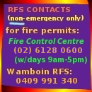
FIRE PERMITS
During this extended BUSHFIRE PERIOD you must obtain a Fire Permit to undertake hazard reduction burns, pile burns, or other open fires.
Fire Permits must be registered and obtained in the first instance from Queanbeyan Fire Control (02) 6128 0600.
The Permit Issuing Officer will if necessary personally inspect the site for the fire, to check the material/s to be burnt and verify that your fire-fighting equipment is suitable, and confirm that it will actually be at the site of the proposed fire. He/she may add any conditions deemed necessary, but as a minimum, all permits have standard conditions that are listed on the permit form, such as:
- the Permit is to be carried by the permit holder, or another person at all times at the site of the fire.
- the fire must be supervised at all times.
- notifications are given to the RFS (Queanbeyan Fire Control Centre), and adjoining neighbors at least 24 hours prior to the fire being lit, and
- the permit may be varied, cancelled or suspended, depending on weather conditions.
A Fire Permit is not required for a fire for the purpose of heating or cooking, provided that:
- the fire is in a permanently constructed fireplace.
- at a site surrounded by ground that is cleared of all combustible materials for a distance of at least two metres all around.
- The fire is completely extinguished before leaving.
Before lighting any fire you need to ensure that:
- it can be contained and controlled within the specified area.
- it does not contain toxic materials, and
- it must not cause an air pollution problem by producing excessive amounts of smoke.
You must also check:
- whether a No Burn day has been declared by the Environment Protection Authority.
- whether a Total Fire Ban is in force.
- the expected weather conditions.
For further information regarding Fire Permits and their use, visit the NSW Rural Fire Service website at www.rfs.nsw.gov.au or ring the Fire Control Centre in Queanbeyan (weekday business hours) on 6297 1840 or Wamboin Rural Fire Brigade Captain on 0409 991 340.
top
BUSH FIRE DANGER PERIOD
BUSHFIRE DANGER PERIOD
(1 October – 31 March)
The statutory bush fire danger period (NSW Rural Fires Act 1997) runs from 1st October to 31st March. This is the time when our area and elsewhere in the State are particularly prone to the threat of wildfire. It is also the time when you need to have your Bushfire Survival Plan prepared and be ready to implement, sometimes at very short notice.
To report fires or smoke sightings ALWAYS ring Triple Zero (000)
FIRE PERMITS
Burning off, if you must do it at all, should be reserved for the cooler months of the year. If, however, you are planning to light a fire in the open between 1st October and 31st March, you will need a Fire Permit.
The Permit Issuing Officer is required to personally inspect the site, check the material to be burnt and check that your fire-fighting equipment is suitable for the job and will actually be at the site of the proposed fire. He/she may add any conditions deemed necessary, but as a minimum, all permits have standard conditions that are listed on the permit form, such as:
- the Permit is to be carried by the permit holder, or another person at all times at the site of the fire.
- the fire must be supervised at all times.
- notifications are given to the RFS (Queanbeyan Fire Control Centre), and adjoining neighbors at least 24 hours prior to the fire being lit, and
- the permit may be varied, cancelled or suspended, depending on weather conditions.
A Fire Permit is not required for a fire for the purpose of heating or cooking, provided that:
- the fire is in a permanently constructed fireplace.
- at a site surrounded by ground that is cleared of all combustible materials for a distance of at least two metres all around.
- The fire is completely extinguished before leaving.
Before lighting any fire you need to ensure that:
- it can be contained and controlled within the specified area.
- it does not contain toxic materials, and
- it must not cause an air pollution problem by producing excessive amounts of smoke.
You must also check:
- whether a No Burn day has been declared by the Environment Protection Authority.
- whether a Total Fire Ban is in force.
- the expected weather conditions.
For further information regarding Fire Permits and their use, visit the NSW Rural Fire Service website at www.rfs.nsw.gov.au or ring the Fire Control Centre in Queanbeyan (weekday business hours) on 6297 1840 or Wamboin Rural Fire Brigade Captain on 0409 991 340.
top25 December 2014
WWoW Christmas Letterbox Decorating Competition
Once again the community mailbox decorating contest brought out our communal creativity. It’s fun to see a bit of special holiday fun as we drive around.
The submissions are judged by the WWOWs from photographs. This year the Wonderful Women of Wamboin shortlisted a group of wonderful submissions (below). In addition, the WWOWs recognised the work done by children, and each child named in a submission received a personalised tree ornament with surprises inside.
The first prize basket of goodies went to 77 Bingley Way, Wamboin for its humour, topical nature, and creative re-use of a child's "jeep". [ How sad, that after the photograph was taken, person(s) unknown took away the jeep and Santa. Neighbours have replaced them with something similar, but not what the children put together.]

The second prize basket went to 64 Majors Close.

There where many honourable mentions. Below a collage of some of the shortlisted Decorating Competition entries.

A big thank you to everyone who participated and helped to make Christmas a merry affair in Wamboin and Bywong.
topHazard Reduction
Pile Burn Advisory
Planning, Notifications, and other considerations
What Is A Pile Burn
A pile burn is the burning of cut and stacked vegetation.
A pile burn would normally comprise vegetation resulting from removal of bush fire fuels or property maintenance such as fallen or cut branches from bushes or trees, prunings and leaf litter from around buildings or other assets on your property.
You may only burn vegetation emanating from your property, no household waste or building materials.
While fire can be a useful tool for reducing bush fire hazards, alternatives such as composting or removing the material from your property should also be considered.
Pile Burns between 1st April – 30th September
Outside the declared bushfire danger period (normally 1st April to 30th September) a Fire Permit is not required to burn off in the open (unless the burn could be of danger to a building). There are however, certain mandatory notification requirements to your neighbours, other property holders in your vicinity and the local Fire Control Centre see details below.
Pile Burns between 1st October – 31st March
During the declared bushfire danger period (normally 1st October - 31st March, but the dates can be widened if the danger levels warrant tighter controls), a Fire Permit is required for any fire lit in the open.
For further advice and to seek a Fire Permit contact the local Fire Control Centre (Lake George Zone FCC in Queanbeyan) on (02) 6128 0600 during weekday business hours.
Note:Management including containment of a fire originating on your property is your responsibility. Don’t light the fire if you are concerned about current or expected weather conditions on the day or it is a day of Total Fire Ban. If you are contemplating a pile burn you will find that a pile that no greater than 2 metres long and 1.5 metres high works best; it will be more manageable and produce less heat. Ensure there is a sufficiently cleared area around the pile. Also make sure that you are appropriately dressed, have an adequate continuous water supply to contain or extinguish the fire, and remain vigilant until the fire is extinguished. Further general information can be found on the NSW Rural Fire Service website.
Notification Requirements
In all cases, regardless of when you plan to light a fire in the open, you need to notify:
- your neighbours and other property holders in your vicinity at least 24 hours before you light the fire, and
- the local Fire Control Centre (Lake George Zone FCC in Queanbeyan) on (02) 6128 0600 during weekday business hours at least 24 hours before you light the fire.
Your thoughtfulness will help minimise neighbour anxiety and unnecessary brigade call-outs.
Should the fire escalate to become more than you can handle, don’t hesitate, ring Triple Zero (000).
PREPARE. ACT. SURVIVE.
Secretary
Wamboin Volunteer Rural Fire Brigade
BUSH FIRE DANGER PERIOD
BUSHFIRE DANGER PERIOD
(1 October – 30 April)
Although the statutory bush fire danger period (NSW Rural Fires Act 1997) nominally runs from 1st October to 31st March, NSW has extended the BUSHFIRE DANGER PERIOD for our LGA to 30 April 2015.
To report fires or smoke sightings ALWAYS ring Triple Zero (000)
FIRE PERMITS
During this extended BUSHFIRE PERIOD you must obtain a Fire Permit to undertake hazard reduction burns, pile burns, or other open fires.
The Permit Issuing Officer is required to personally inspect the site, check the material to be burnt and check that your fire-fighting equipment is suitable for the job and will actually be at the site of the proposed fire. He/she may add any conditions deemed necessary, but as a minimum, all permits have standard conditions that are listed on the permit form, such as:
- the Permit is to be carried by the permit holder, or another person at all times at the site of the fire.
- the fire must be supervised at all times.
- notifications are given to the RFS (Queanbeyan Fire Control Centre), and adjoining neighbors at least 24 hours prior to the fire being lit, and
- the permit may be varied, cancelled or suspended, depending on weather conditions.
A Fire Permit is not required for a fire for the purpose of heating or cooking, provided that:
- the fire is in a permanently constructed fireplace.
- at a site surrounded by ground that is cleared of all combustible materials for a distance of at least two metres all around.
- The fire is completely extinguished before leaving.
Before lighting any fire you need to ensure that:
- it can be contained and controlled within the specified area.
- it does not contain toxic materials, and
- it must not cause an air pollution problem by producing excessive amounts of smoke.
You must also check:
- whether a No Burn day has been declared by the Environment Protection Authority.
- whether a Total Fire Ban is in force.
- the expected weather conditions.
For further information regarding Fire Permits and their use, visit the NSW Rural Fire Service website at www.rfs.nsw.gov.au or ring the Fire Control Centre in Queanbeyan (weekday business hours) on 02 6128 0600 or Wamboin Rural Fire Brigade Captain on 0409 991 340.
topFriday-Sunday 20-22 June 2014
DSMRA’s Kowen Forest Ride - CLOSURE
Kowen Forest will be CLOSED
The Dual Sport Motorcycle Riders Association ACT Branch (DSMRA) annual Kowen Forest Ride, originally scheduled for April, was postponed due to wet weather and has now been rescheduled to 20-22 June 2014.
The DSMRA would like to notify all residents in the Wamboin area that Kowen Forest will be CLOSED to the public from 5pm on Friday 20 June 2014 to 12:00 midnight Sunday 22 June 2014. This closure does not apply to the areas known as Sparrow Hill, Orchard Block or the car park recreation area at the bottom of Molonglo Gorge. Relevant signage will be posted around the closed sections.
The forest will be closed for a non-competitive motorcycling event - the DSMRA's Kowen Forest Ride 2014. This ride is held over two days and is organised as an annual membership drive for our association. It also raises money for charities such as the Snowy Hydro Rescue Helicopter and ACT SES branches.
All bikes are registered and each rider must have a valid motorcycle licence. All riders are required to comply with the 40km/h forest speed limit and will not enter the motorsport exclusion zone, particularly the area adjacent to the northern boundary of the forest on "Wamboin Break".
The section of Seven Mile Road adjacent to Wamboin will not be used as a transport section for DSMRA riders, however we have been advised current forestry operations will continue in that area.
Preparations for the DSMRA event will commence from 10:30am Friday 20 June 2014. Riders who have travelled from interstate and intend to camp (at the old Depot site), and suppliers delivering event infra-structure, will start to arrive from this time. Notices will be put up before the event advising of the forest closure. "Forest Closed" signs will be deployed at more than 50 locations around the forest perimeter.
As Kowen Forest is declared closed by TAMS, the DSMRA advises residents, walkers, runners, hikers, horse riders, bicycle riders and any other recreational forest users, not to enter the forest during the closure. Entering the forest during the closure may endanger you, domestic animals, and the DSMRA riders.
As this is not a spectator event there will be NO PUBLIC ACCESS via Seven Mile Road, Kowen Rd (the main gate), Millpost Lane (at either the seismic station gates or the sheep boundary gate), Charcoal Kiln Rd, or any other entry point, for the specified closure period.
The forest will be re-opened to the public from Monday morning after the event. Please be aware there will be increased traffic on Kowen Rd and areas around the Depot site for preparation on the days before and the tidy up after the event.
However please be aware that there will be increased traffic on Kowen Rd and areas around the Depot site for preparation and the tidy up on the days before and after the event.
If you have any questions, please contact Territory and Municipal Services (TAMS) on 6205 9883 or DSMRA Duty Officer by telephone 0490 456 041 or by email: kowencomm@dsmra.asn.au.
topFriday-Sunday 11-13 April 2014
DSMRA’s Kowen Forest Ride - CLOSURE
Kowen Forest will be CLOSED
The Dual Sport Motorcycle Riders Association (DSMRA) would like to notify all residents in the Wamboin area that Kowen Forest will be CLOSED to the public from 5:00 pm Friday 11th April to 12:01 am on Monday 14 April 2014. This closure does not apply to the areas known as Sparrow Hill and Orchard Block.
The forest will be closed for a non-competitive motorcycling event - the DSMRA’s Kowen Forest Ride 2014. This ride is held over two days and is organised as an annual membership drive for our association. It also raises money for charities such as the Snowy Hydro Rescue Helicopter and funds for the ACT SES. All bikes are registered and each rider must have a motorcycle licence. All riders are required to comply with the 40km/h forest speed limit and will not enter the motorsport exclusion zone particularly that which is adjacent to the northern boundary of the forest on Wamboin Break.
The section of Seven Mile Road adjacent to Wamboin will not be used as a transport section for riders – though current forest operations will continue to use that area.
Preparations for the event will commence from 10:30 am Friday 11 April 2014. Riders who have travelled from interstate and intend to camp (at the old Depot site), as well as others delivering event infra-structure, will start to arrive from this time. Notices will be put up before the event advising of the forest closure. “Forest Closed” signs will be deployed at more than 50 locations around the forest perimeter.
The DSMRA requests that residents, walkers, runners, hikers, horse riders and bicycle riders do not enter the forest during the closure, as this may endanger you, your animals and the riders.
As this is not a spectator event there will be NO PUBLIC ACCESS via Seven Mile Road, Kowen Rd (the main gate), Millpost Lane (at either the seismic station gates or the sheep boundary gate), Charcoal Kiln Rd etc for the specified period.
The forest will be re-opened after the event, and open to the public for Monday morning.
However please be aware that there will be increased traffic on Kowen Rd and areas around the Depot site for preparation and the tidy up on the days before and after the event.
If you have any questions, please contact Territory and Municipal Services (TAMS) – 6205 9883 or DSMRA (Doug Waterhouse) – 0407 259 338 /email: pbr0110@bigpond.net.au
top28 March – 4 May 2014
Fox Baiting
Greater Goorooyarroo Pest Animal Target Area
From 28th March until 4th May 2014 a number of landholders on Millynn Road, Schofield Lane and Bungendore Road in Bywong will be undertaking a 1080 fox baiting programme in accordance with the PESTICIDES ACT 1999 – PESTICIDE CONTROL ORDER UNDER SECTION 38.

Although every precaution is always taken, you should be mindful of the potential for non-target species to pick up baits, especially dogs. This baiting programme is part of the Greater Goorooyarroo project.
For more information please contact Greening Australia Capital Region.
All participating properties will be clearly signed.
top21 December 2013
WWoW Christmas Letterbox Decorating Competition
The results are in! And the winners of the 2013 Christmas Letterbox and Gate Decorating Competition are:

1st prize to the Francis family, Hogan Drive for their flying kangaroos

2nd prize to the Ruting family, Brooks Road for their three wise men.
A big thank you to everyone who participated and helped to make Christmas a merry affair in Wamboin and Bywong.
top15–20 December 2013
WWoW Christmas Letterbox Decorating Competition
The following is a montage of the finalists for the 2013 Wamboin/Bywong letterbox and gate decorating competition. The competition was sponsored by the Wonderful Women of Wamboin who thank all those who decorated, and congratulate the shortlisted artists on their creativity and workmanship.

The winners will be announced shortly...
top
BUSH FIRE DANGER PERIOD
BUSHFIRE DANGER PERIOD
(1 October – 31 March)
The statutory bush fire danger period (NSW Rural Fires Act 1997) runs from 1st October to 31st March. This is the time when our area and elsewhere in the State are particularly prone to the threat of wildfire. It is also the time when you need to have your Bushfire Survival Plan prepared and be ready to implement, sometimes at very short notice.
To report fires or smoke sightings ALWAYS ring Triple Zero (000)
FIRE PERMITS
Burning off, if you must do it at all, should be reserved for the cooler months of the year. If, however, you are planning to light a fire in the open between 1st October and 31st March, you will need a Fire Permit.
The Permit Issuing Officer is required to personally inspect the site, check the material to be burnt and check that your fire-fighting equipment is suitable for the job and will actually be at the site of the proposed fire. He/she may add any conditions deemed necessary, but as a minimum, all permits have standard conditions that are listed on the permit form, such as:
- the Permit is to be carried by the permit holder, or another person at all times at the site of the fire.
- the fire must be supervised at all times.
- notifications are given to the RFS (Queanbeyan Fire Control Centre), and adjoining neighbors at least 24 hours prior to the fire being lit, and
- the permit may be varied, cancelled or suspended, depending on weather conditions.
A Fire Permit is not required for a fire for the purpose of heating or cooking, provided that:
- the fire is in a permanently constructed fireplace.
- at a site surrounded by ground that is cleared of all combustible materials for a distance of at least two metres all around.
- The fire is completely extinguished before leaving.
Before lighting any fire you need to ensure that:
- it can be contained and controlled within the specified area.
- it does not contain toxic materials, and
- it must not cause an air pollution problem by producing excessive amounts of smoke.
You must also check:
- whether a No Burn day has been declared by the Environment Protection Authority.
- whether a Total Fire Ban is in force.
- the expected weather conditions.
For further information regarding Fire Permits and their use, visit the NSW Rural Fire Service website at www.rfs.nsw.gov.au or ring the Fire Control Centre in Queanbeyan (weekday business hours) on 6297 1840 or Wamboin Rural Fire Brigade Captain on 0409 991 340.
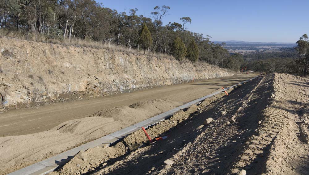
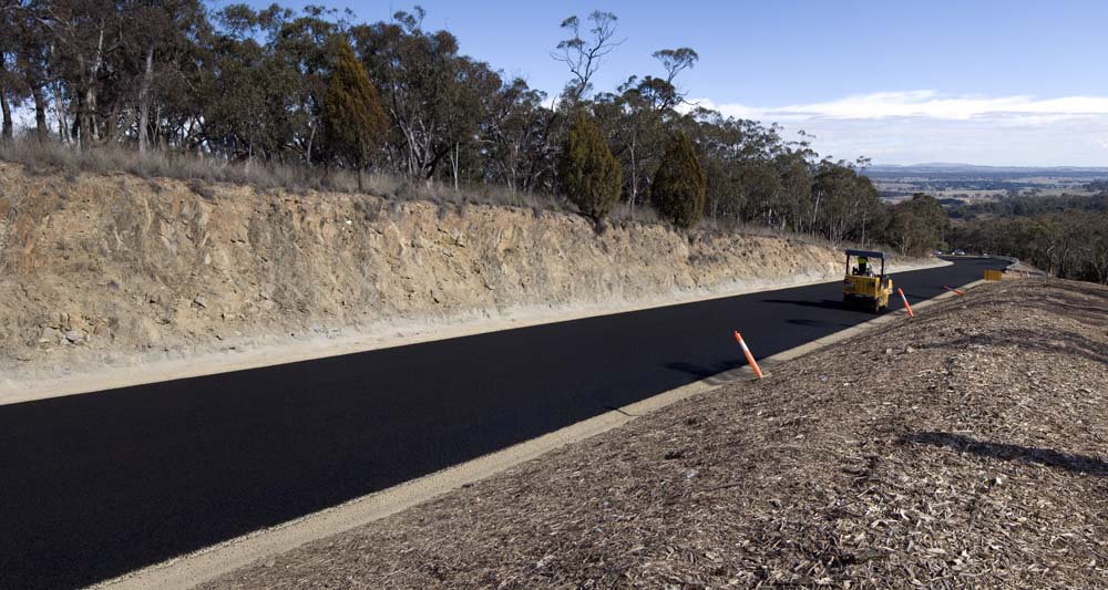
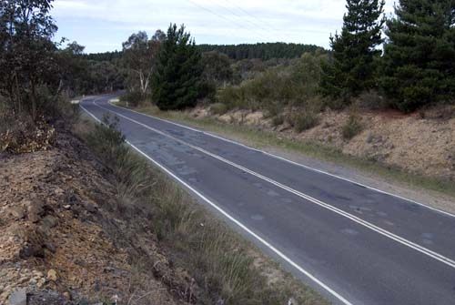
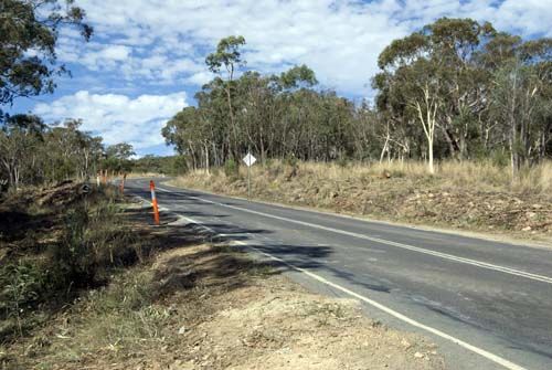
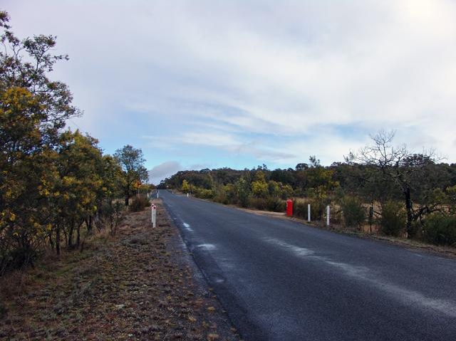
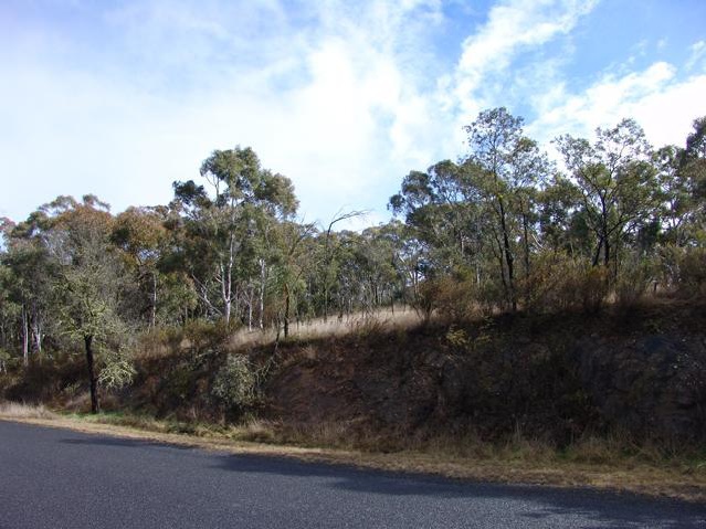
top2 August 2013
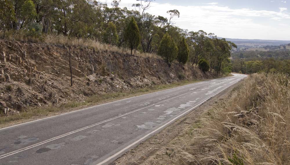
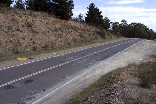
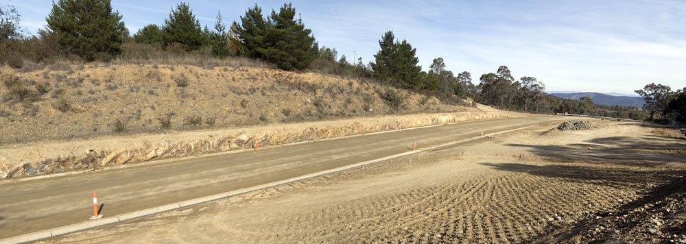
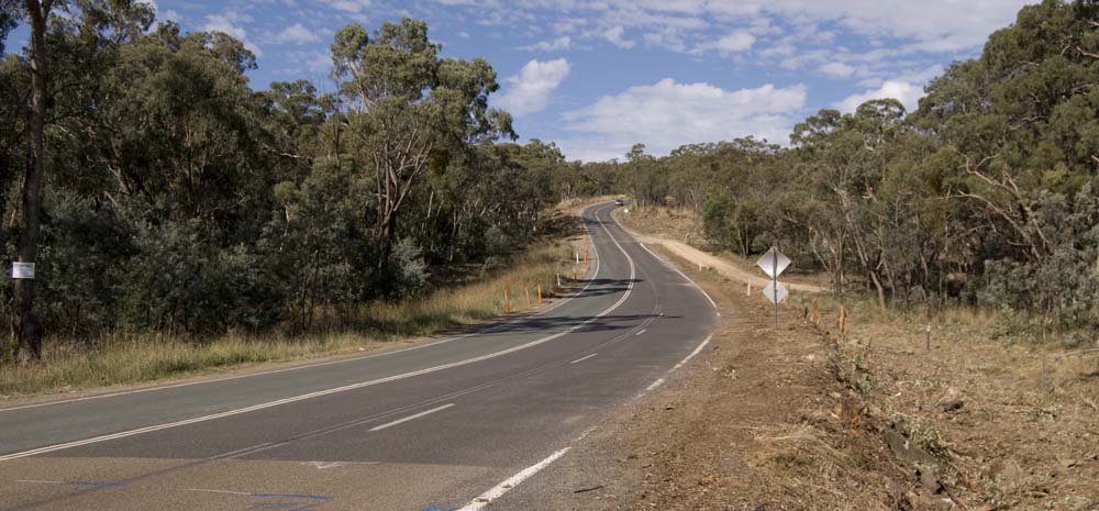
Macs Reef Road Rehabilitation
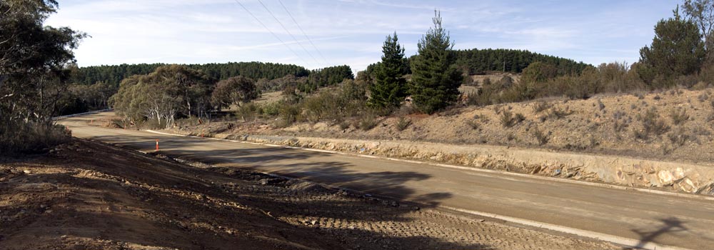
After the weather delays of the last couple of weeks, the primerseal was laid on most of the new work today. Being laid in the colder weather, this in initial bitumen seal must be 'thinned' with kerosene so that it spreads satisfactorily. If we have a warm summer, the kerosene will bleed off quickly and the final seal can be applied then, otherwise the final seal will probably not go on until late in 2014. The road will be line-marked in the coming weeks.
March 16
May 3
May 10
May 17
June 9
August 2
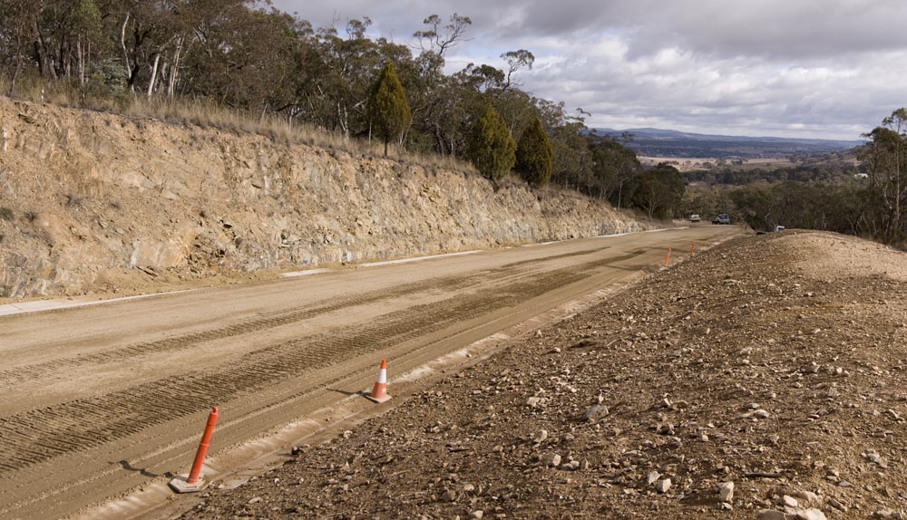
9 June 2013
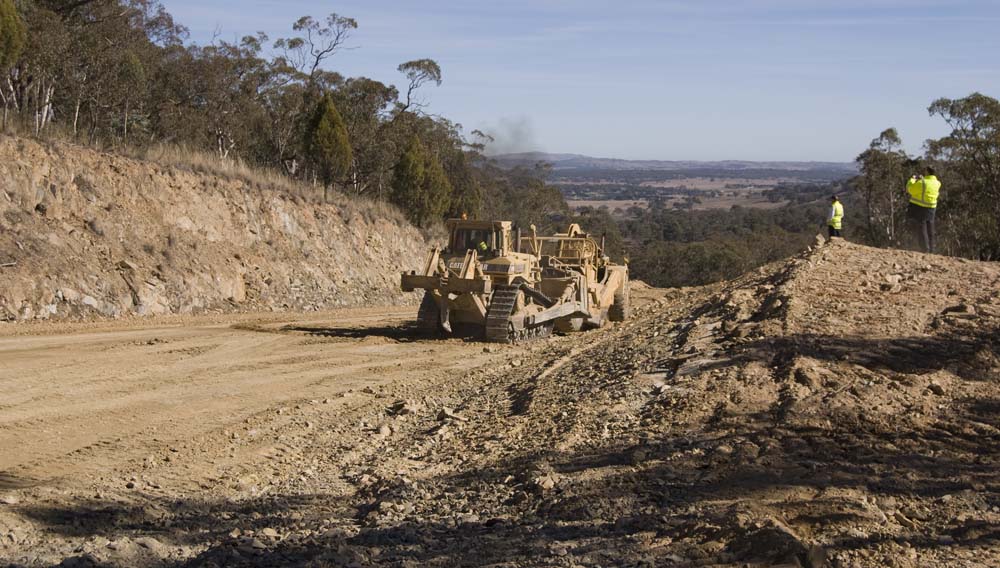
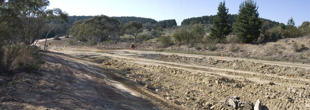
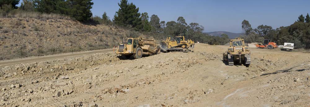
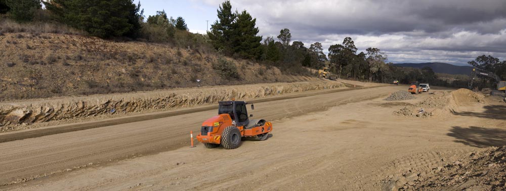
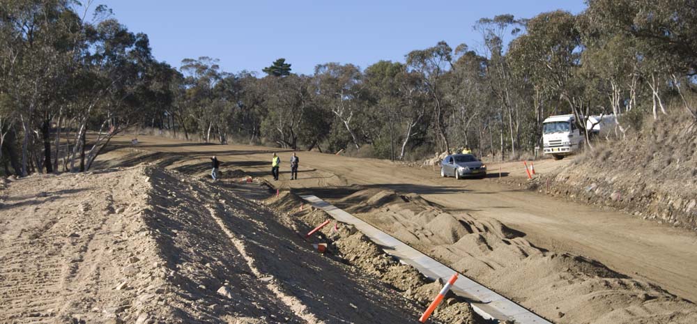
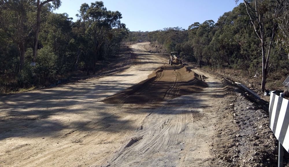
Macs Reef Road Rehabilitation
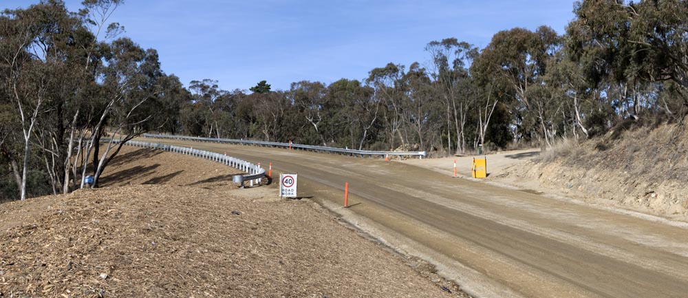
The drains are complete and the guard rails have been installed. Many of the disturbed earthworks areas have been mulched. The road widening around the entrance to the tip and new waste transfer station has commenced.
At the top of the hill
March 16
April 12
May 3

May 17
June 9
March 16
April 12
May 3
May 17
June 9
Half way down
March 16
May 10
May 17

June 9
March 16
May 3
May 10
May 17
June 9
Up the hill from Bankers Road
March 16
May 3

May 10
May 17
June 9
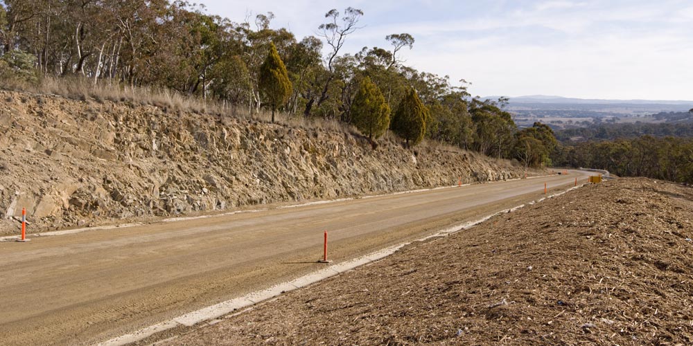
17 May 2013
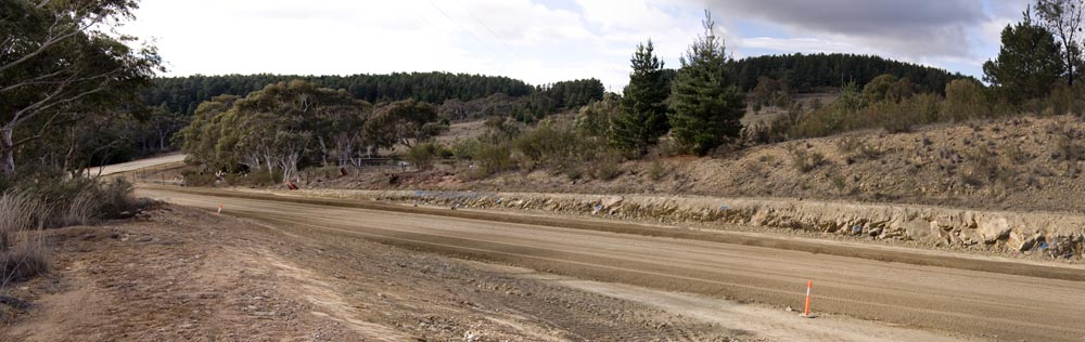
Macs Reef Road Rehabilitation
The road is once again open to traffic, and it's looking good. There's still a bit more concreting to do (drains), and gravel to lay down, but the project is comfortably on schedule for completion by early July.
At the top of the hill
March 16
April 12
May 3
May 17
March 16
April 12
May 3
May 17
Half way down
March 16
May 10
May 17
March 16
May 3
May 10
May 17
Up the hill from Bankers Road
March 16
May 3
May 10
May 17
10 May 2013
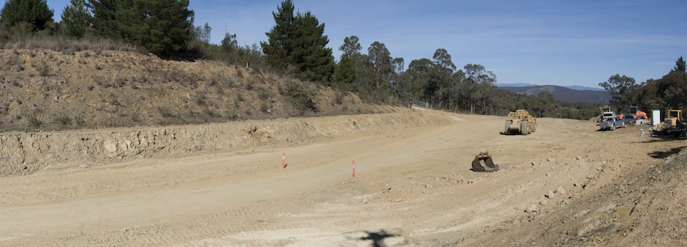
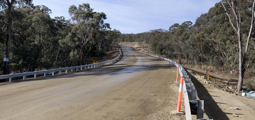
Macs Reef Road Rehabilitation
Four weeks in and we're doing the kerbs and laying down the sub-base, comfortably on schedule for reopening to traffic on 17 May. The sealing, line marking and barriers will then be completed 'under traffic'.
At the top of the hill
March 16
April 12
May 3
March 16
April 12
May 3
Half way down
March 16
May 10
March 16
May 3
May 10
Up the hill from Bankers Road
March 16
May 3
May 10
3 May 2013
Macs Reef Road Rehabilitation
Three weeks in and the heavy work is done at the the top of the hill.
March 16
April 12
May 3
March 16
April 12
May 3
Further down, it's almost complete.
March 16
May 3
March 16
May 3
12 April 2013
Macs Reef Road Rehabilitation
Five days in and the heavy equipment continues work at the the top of the hill.
March 16
April 12
March 16
April 12
17 March 2013
Works Begin on Macs Reef Road
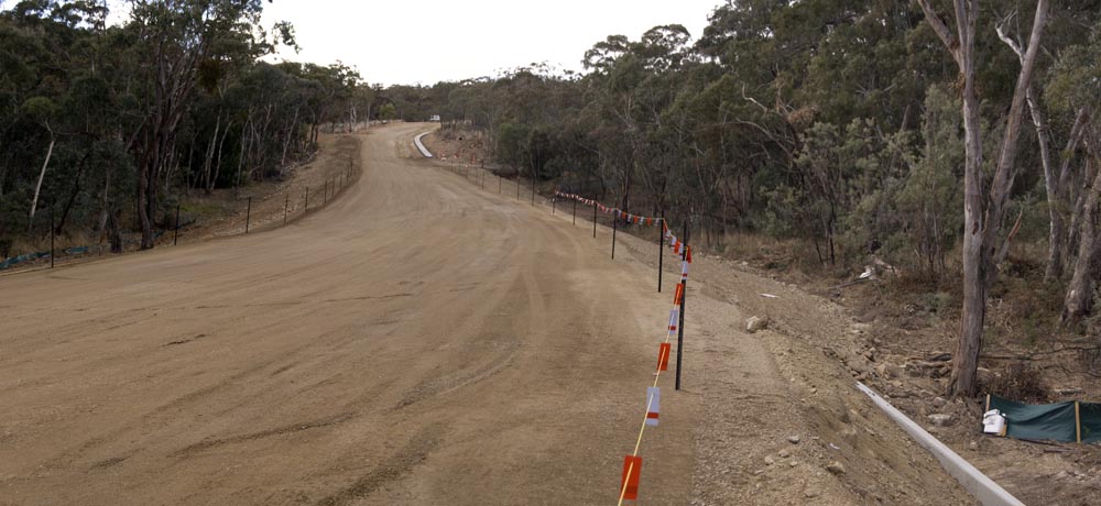
Initial preparations are underway for the major rehabilitation work on Macs Reef Road. Residents will have noticed surveying and clearing works on the road verges in recent days.
The following photos are a snapshot taken yesterday (March 16). We'll provide periodic updates as we can.

March-July 2013
Macs Reef Road Rehabilitation
In the coming months, the section of Macs Reef Road between Bankers Road and Newington Road will be undergoing major rehabilitation works.
Of particular note is the fact that, from 8 April to 17 May 2013 THIS SECTION OF MACS REED ROAD WILL BE CLOSED TO ALL TRAFFIC. For the duration of the roadworks, and for this period in particular, motorists are advised to familiarise themselves with and use alternate routes. It takes only a couple of minutes longer for through traffic to access the Federal Highway via Bungendore Road and, even when Macs Reef Road is again open to through traffic, delays can be expected while the roadworks are completed.
- Federal Highway traffic should detour via Bungendore Road.
- Sutton Road traffic should detour via [Denley Drive/Weeroona Drive/]Norton Road.
When the major earthworks are complete, Macs Reef Road will again be open to through traffic. Motorists are nonetheless advised that delays can be expected throughout and to use alternate routes for the duration of the roadworks.
For further information, contact:
Barry Osmond
Works Supervisor
Palerang Council
Ph: 02 6238 8111
Fax: 02 6238 1290
Email: records@palerang.nsw.gov.au
19 February 2013
Draft Palerang Local Environmental Plan
There's a great deal of anxiety circulating unnecessarily in parts of the community at the moment over land use zoning in the draft PLEP.
Be assured that WCA representatives were present at every council meeting that dealt with the development of the new PLEP, to represent the interests of our local community. In particular, Council took advice from the WCA when identifying the zoning for the area and the land uses that would be permitted with or without consent.
The use of new zones and land use definitions has been mandated by the NSW government—it's not something that Palerang Council has done off its own bat. Any apparent anomalies are likely just oversights that will be corrected as soon as they are brought to council's attention.
If there are any omissions or oversights in the way the old zoning and land use have been translated onto the terms of the new LEP, it's most likely that they are just that—simply errors. One of the primary functions of the current public exhibition phase of the PLEP development process is to identify these errors. The intent was always to do a simple one-to-one map, to effectively allow everything that was currently allowed. Given, however, that council is required to use a different basic document template and a different land use 'dictionary', the mapping process was never going to be easy.
In particular and contrary to rumours that are circulating, general agricultural activities such as grazing are considered to be ancillary activities in a rural residential area (no matter what the zoning E4 or R5, or anything else for that matter) and do not require development consent.
At this stage, there's no point losing sleep over anything. The most helpful thing residents can do is to write down their concerns and forward them to council (email to records@palerang.nsw.gov.au is fine, but you can use paper and an envelope too!). Most of the issues that have been raised to date are the result of misunderstandings, either of the structure of the document itself, of the meaning of the new terms, or of basic planning practices.
Residents should understand that, as has always been the case when regulations change, existing use rights prevail—you can continue to do anything that is currently legally allowed, in perpetuity, and these rights remain with the land (i.e. they are not extinguished with a change of ownership).
Chinese whispers are funny when they're part of a game, but quite unproductive when they deal with real world situations. If you hear something about the new regulations that sounds unbelievable, then it's probably the result of a misunderstanding. Before wasting any energy worrying about the consequences, contact either the Palerang Council planning department (see council's website for details), or email one of your local councillors to seek clarification.
topSummer 2012-2013
Pile Burn Advisory
Planning, Notifications, and other considerations
What Is A Pile Burn
A pile burn is the burning of cut and stacked vegetation.
A pile burn would normally comprise vegetation resulting from removal of bush fire fuels or property maintenance such as fallen or cut branches from bushes or trees, prunings and leaf litter from around buildings or other assets on your property.
You may only burn vegetation emanating from your property, no household waste or building materials.
While fire can be a useful tool for reducing bush fire hazards, alternatives such as composting or removing the material from your property should also be considered.
Pile Burns between 1st April – 30th September
Outside the declared bushfire danger period (normally 1st April to 30th September) a Fire Permit is not required to burn off in the open (unless the burn could be of danger to a building). There are however, certain mandatory notification requirements to your neighbours, other property holders in your vicinity and the local Fire Control Centre see details below.
Pile Burns between 1st October – 31st March (the bushfire danger period)
During the declared bushfire danger period (normally 1st October - 31st March) a Fire Permit is required for any fire in the open.
For further advice and to seek a Fire Permit contact the local Fire Control Centre (Lake George Zone FCC in Queanbeyan) on (02) 6297 1840 during weekday business hours.
Note:Management including containment of a fire originating on your property is your responsibility. Don’t light the fire if you are concerned about current or expected weather conditions on the day or it is a day of Total Fire Ban. If you are contemplating a pile burn you will find that a pile that no greater than 2 metres long and 1.5 metres high works best; it will be more manageable and produce less heat. Ensure there is a sufficiently cleared area around the pile. Also make sure that you are appropriately dressed, have an adequate continuous water supply to contain or extinguish the fire, and remain vigilant until the fire is extinguished. Further general information can be found on the NSW Rural Fire Service website.
Notification Requirements
In all cases, regardless of when you plan to light a fire in the open, you need to notify:
- your neighbours and other property holders in your vicinity at least 24 hours before you light the fire, and
- the local Fire Control Centre (Lake George Zone FCC in Queanbeyan) on 6297 1840 during weekday business hours at least 24 hours before you light the fire.
Your thoughtfulness will help minimise neighbour anxiety and unnecessary brigade call-outs.
Should the fire escalate to become more than you can handle, don’t hesitate, ring Triple Zero (000).
PREPARE. ACT. SURVIVE.
John Taubman
Secretary
Wamboin Volunteer Rural Fire Brigade
20 September 2012
Palerang Mayoral Election
WCA President and returning councillor Pete Harrison was elected, unopposed, mayor of Palerang at the extraordinary meeting of Palerang Council on 20 September 2012.
Returning councillor Paul Cockram was re-elected Deputy Mayor.
top11 January 2012
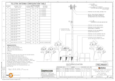
Mobile Phone Tower for Wamboin/Bywong
DA.2011.329 (formerly DA.2011.310) 194 Denley Drive—Approved by Council 11 January 2012
Following extensive community consultation, Telstra has finally gained approval to construct a new mobile phone tower to improve service in the Wamboin/Bywong area.
After the brief Wamboin Community Association General Meeting on 20th September, a Telstra team led by Rob Cusack, Telstra Program Delivery, addressed those present. Rob took numerous questions and comments over at least an hour from the audience of 40+ residents of Wamboin and Bywong. He was assisted by Liz Easton of Aurecon (town planner), and two local Telstra Customer & Commercial Service representatives, Dawn Goodburn and Kelly Lolesio.
The audience's questions covered a wide range of concerns, including the coverage to be expected, the levels of radiation to be expected, the community consultation opportunities, the reasons for not proceeding at the Poppet Road and Milpost Hill sites, the sorts of modelling that were carried out and the expected life of the proposed tower.
The site is on the property at 194 Denley Drive, Wamboin. Following the original effort to locate the tower on Millpost Hill, this site is now Telstra's preferred site because it best meets the variety of appropriate criteria, including coverage, a landholder willing to offer the site, environmental considerations and access for construction and maintenance.
The tower receives and transmits wirelessly to residents' phones and other devices. It simultaneously communicates with the broader Telstra network, probably through microwave to the tower at Goorooyaroo, nearer to Sutton.
With the DA now approved, construction should be complete by mid 2012.
The photos, charts and maps relating to the tower, which appear below, were created and supplied by Telstra for the purpose of providing information to Bywong and Wamboin residents.
The following points are of note:
- The demand from our customers for Telstra mobile services is approximately doubling every calendar year
- This customer demand is led by a growing appetite for smart phones and wireless broadband devices
- Existing network base stations can cater for a finite amount of mobile traffic
- The exponential increase in demand for this finite capacity is creating the need for additional infrastructure
- This is particularly evident in areas such as Wamboin and Bywong where existing coverage levels were low
- A new base station is required to meet this growing customer demand for mobile services in Wamboin and Bywong
- Telstra has considered a large number of potential site locations in the Wamboin and Bywong taking into account technical, design, town planning and ownership constraints
- The most suitable location is now considered to be at 194 Denley Drive, Wamboin
- This location offers a number of favourable site conditions including existing mature vegetation that will visually screen much of the facility and sufficient elevation for the technical requirements of the equipment to be satisfied
- The maximum level of radio signal (EME) emitted by the site will be a small fraction of the permissible levels. Predicted levels are 0.11% of the Australian Standard which is 909 times less than permissible levels.
- Telstra met with members of the Wamboin and Bywong communities at the Wamboin Community Association meeting on Tuesday 20th September
Anyone interested in obtaining additional information regarding the development is invited to contact:
Liz Easton
Environmental Planner
Aurecon
Ph: +61 2 9465 5414
Fax: +61 2 9465 5598
Mob: +61 406 096 756
Email: eastone@ap.aurecongroup.com
PO Box 538 Neutral Bay
NSW 2089
http://www.aurecongroup.com
Sources of information on general issues regarding mobile base station deployment and public health and safety include:
Site Views
The following are actual "Before" (left) and projected "After" (right) photos of the proposed mobile phone tower, created and supplied by Telstra. Click on the individual images to enlarge them (the tower is the skinny stalk on the skyline).


Site Plans
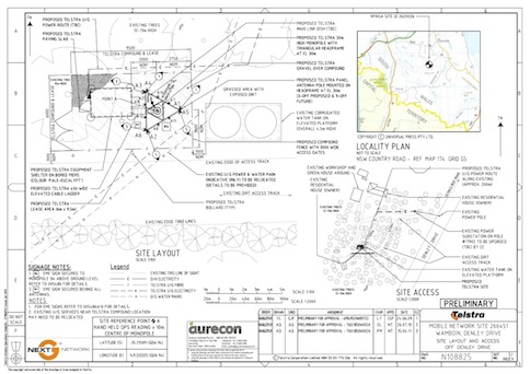
Location Map
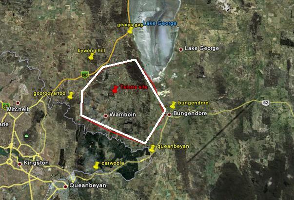
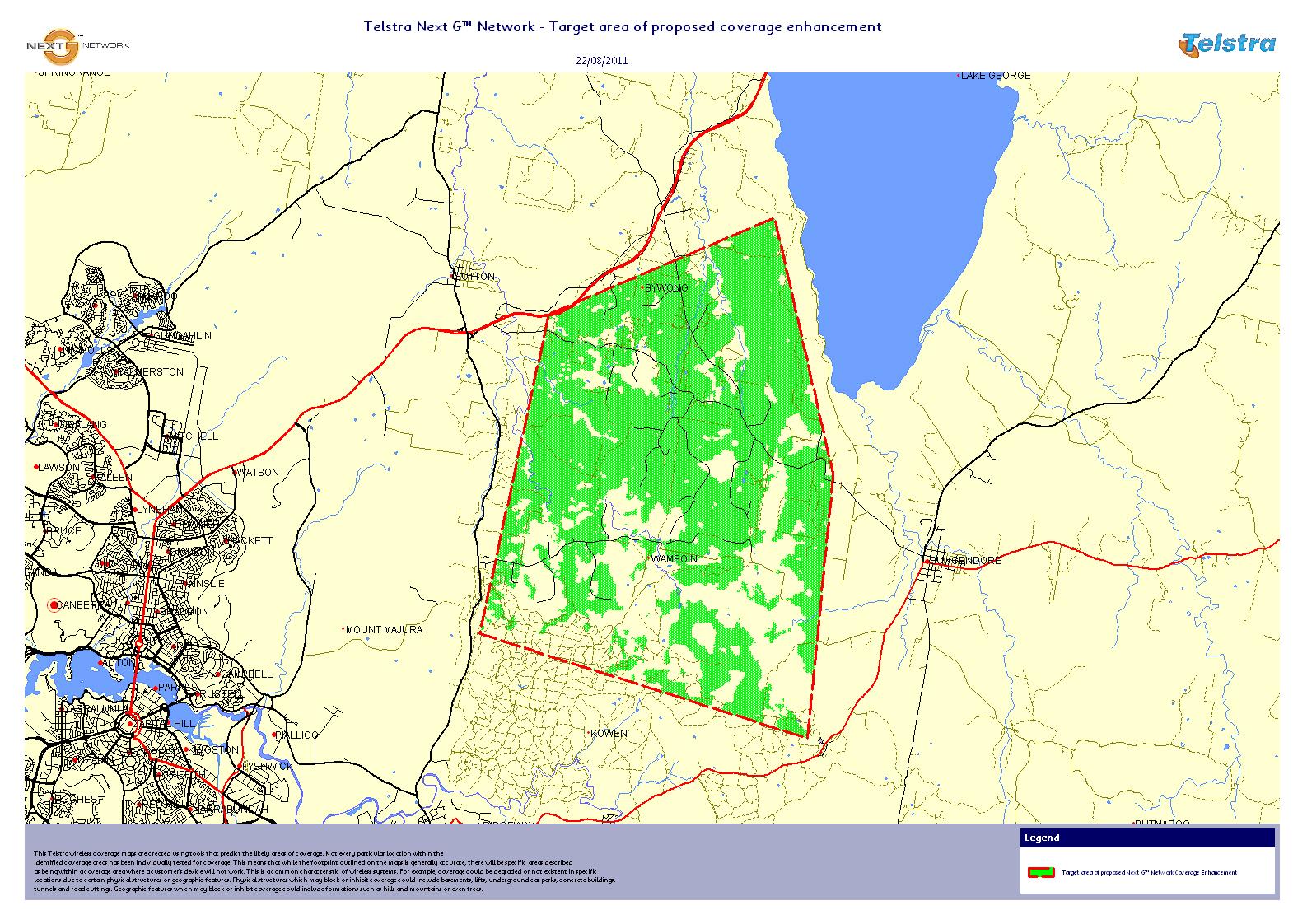
The map below illustrates the existing Telstra mobile phone towers (yellow 'pins') that already service areas in and around Wamboin and Bywong, and the proposed new site on Denley Drive (red pin). The polygon represents the general area where existing coverage would be improved by the proposed new tower.
Coverage Map
The green areas indicate where it is predicted that the new tower will provide high quality, in building, broadband coverage. There may be coverage improvements of a lesser degree to areas that are not shaded but it is not possible to further qualify these improvements in this format.
 top
top1 August 2011
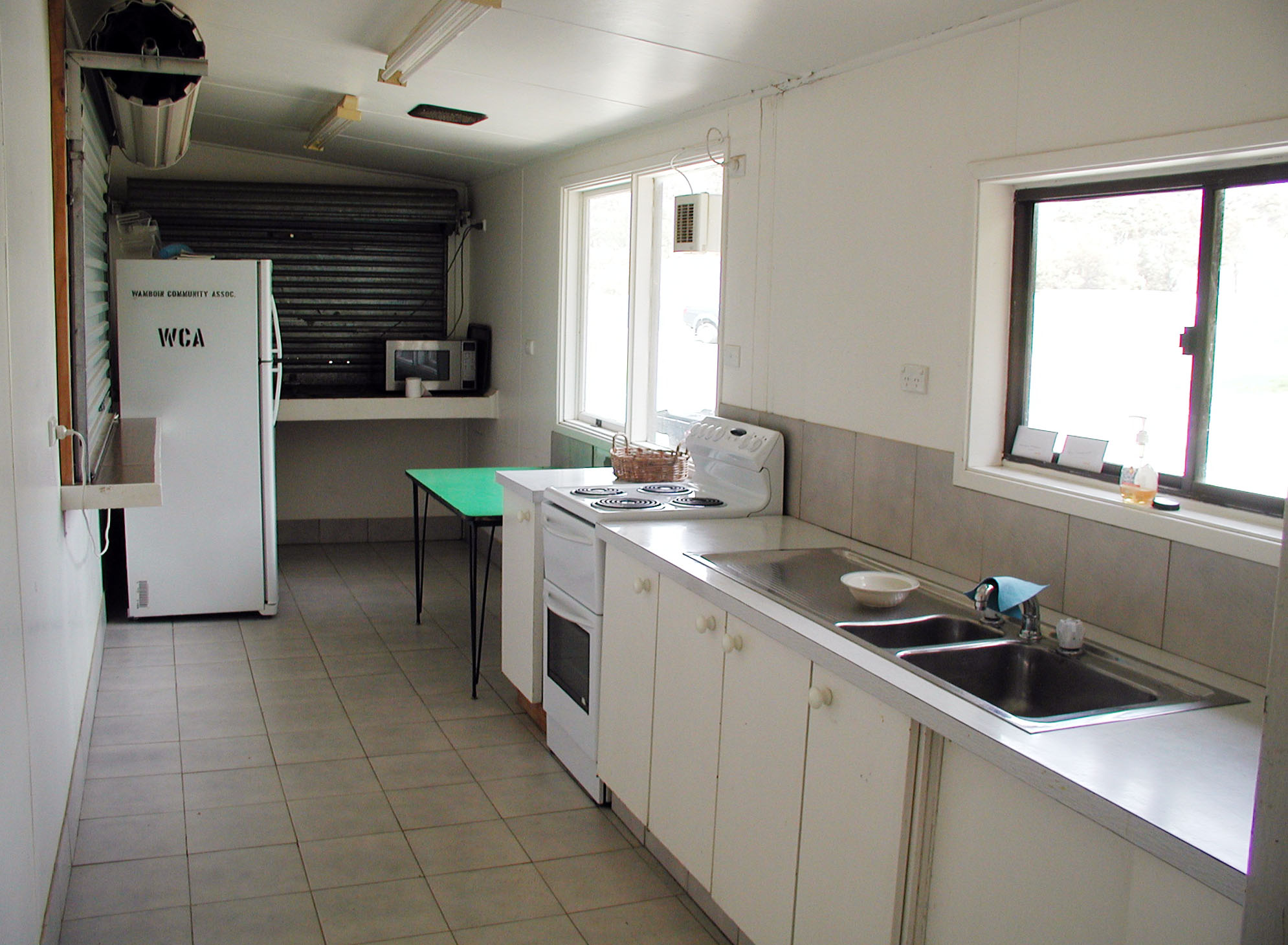
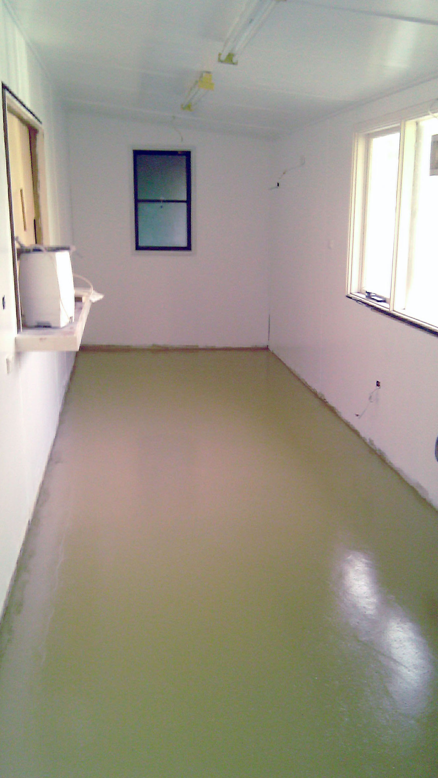
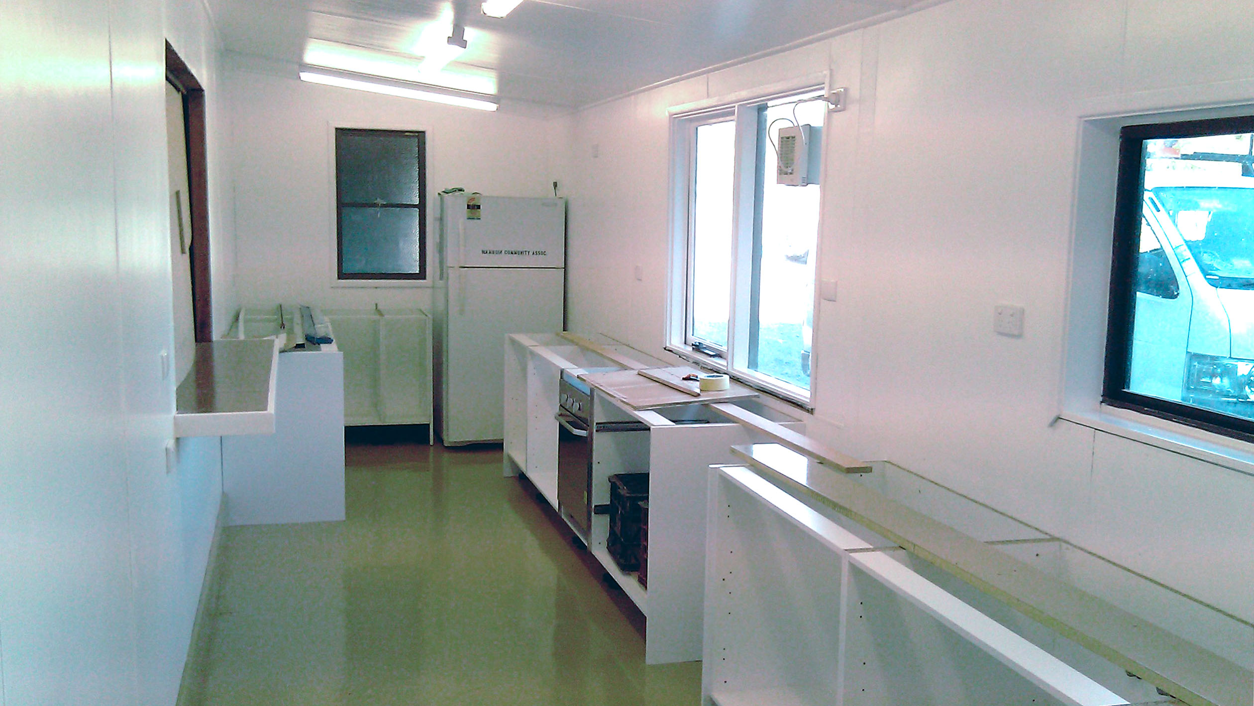
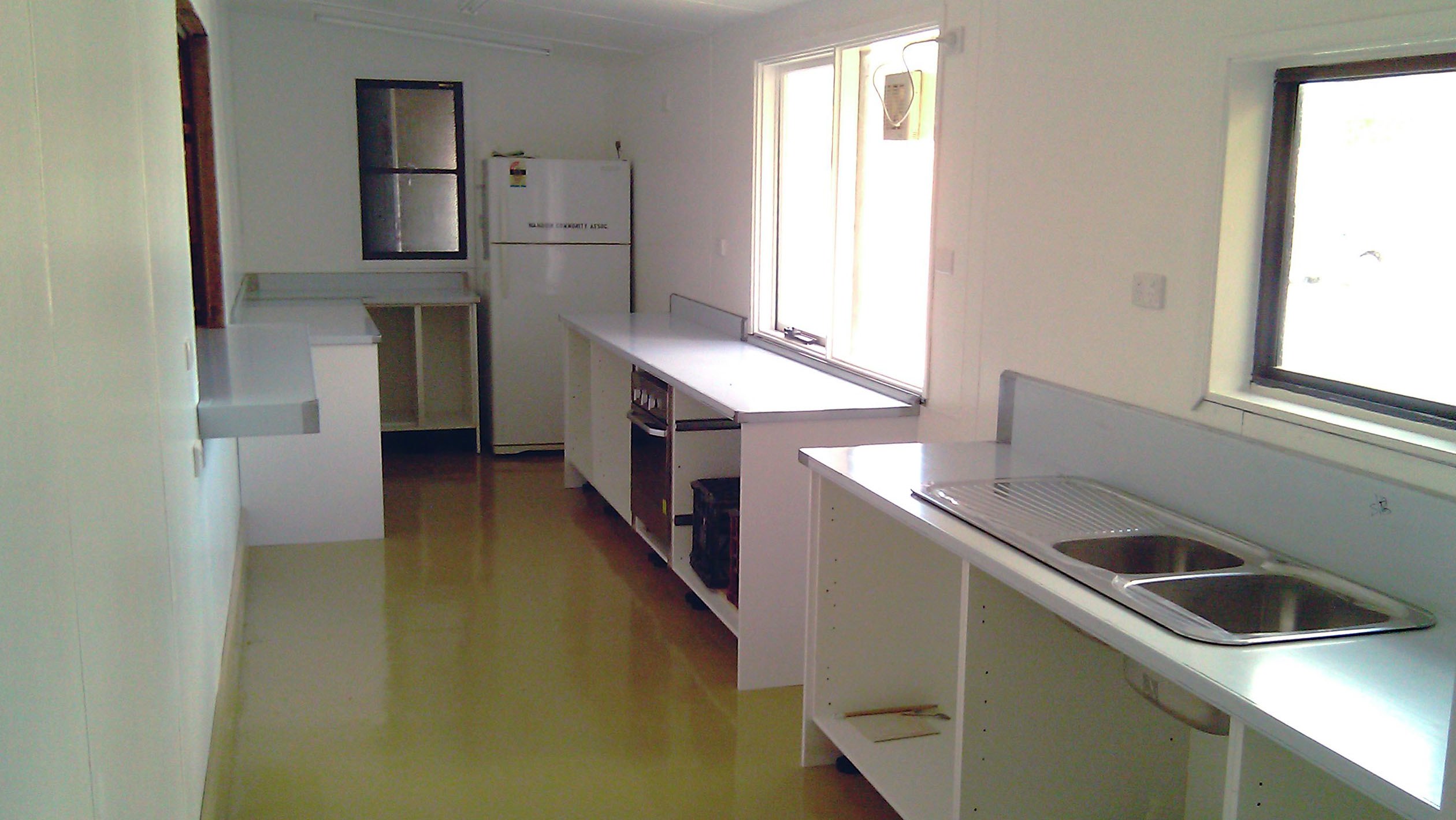
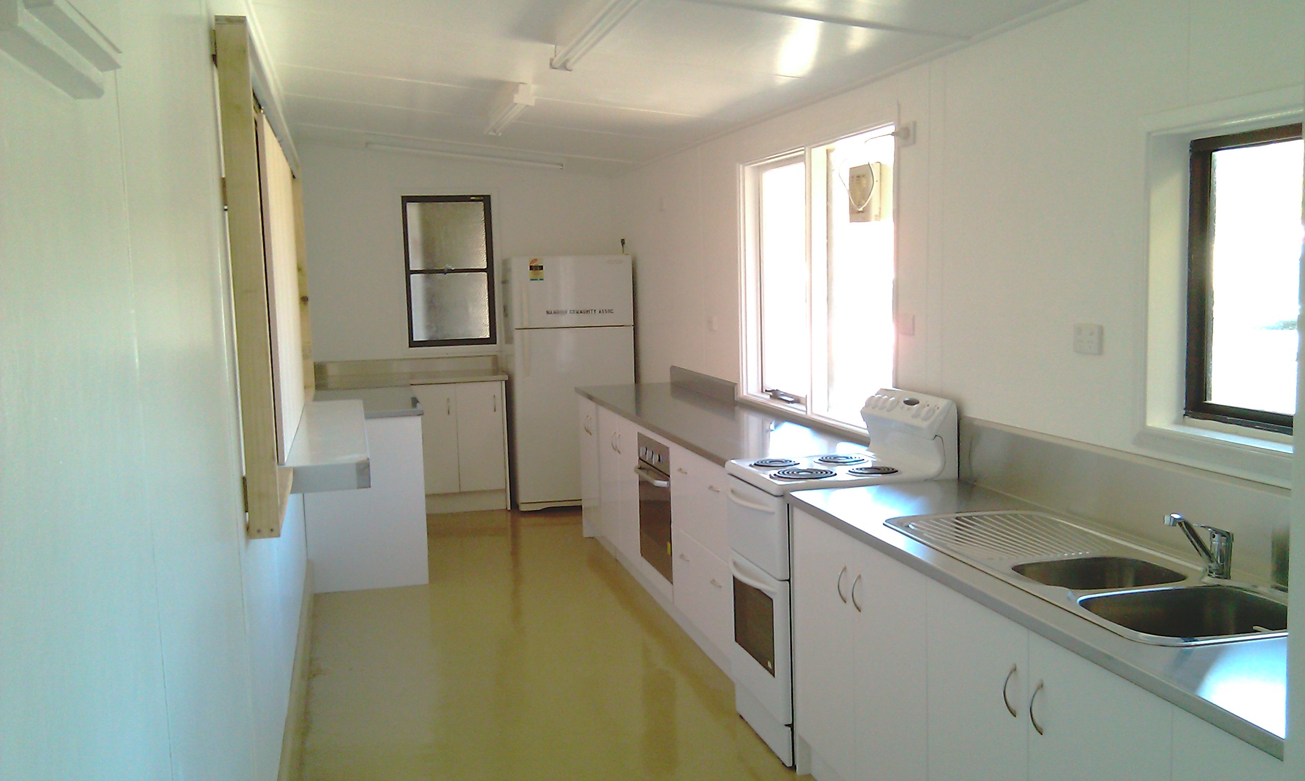
The Wamboin Community Hall gets a new Kitchen
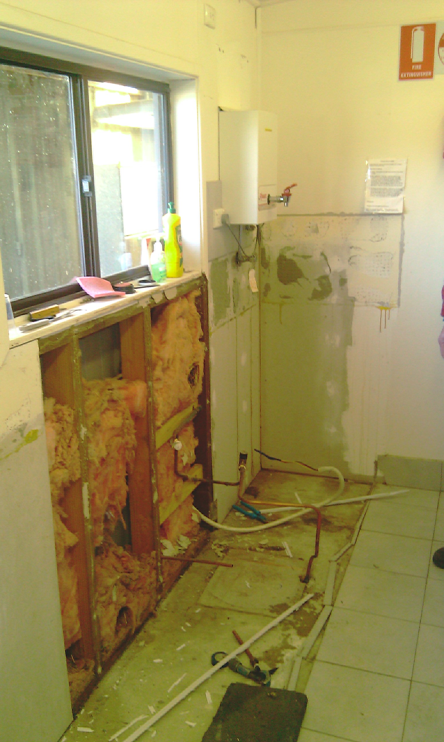
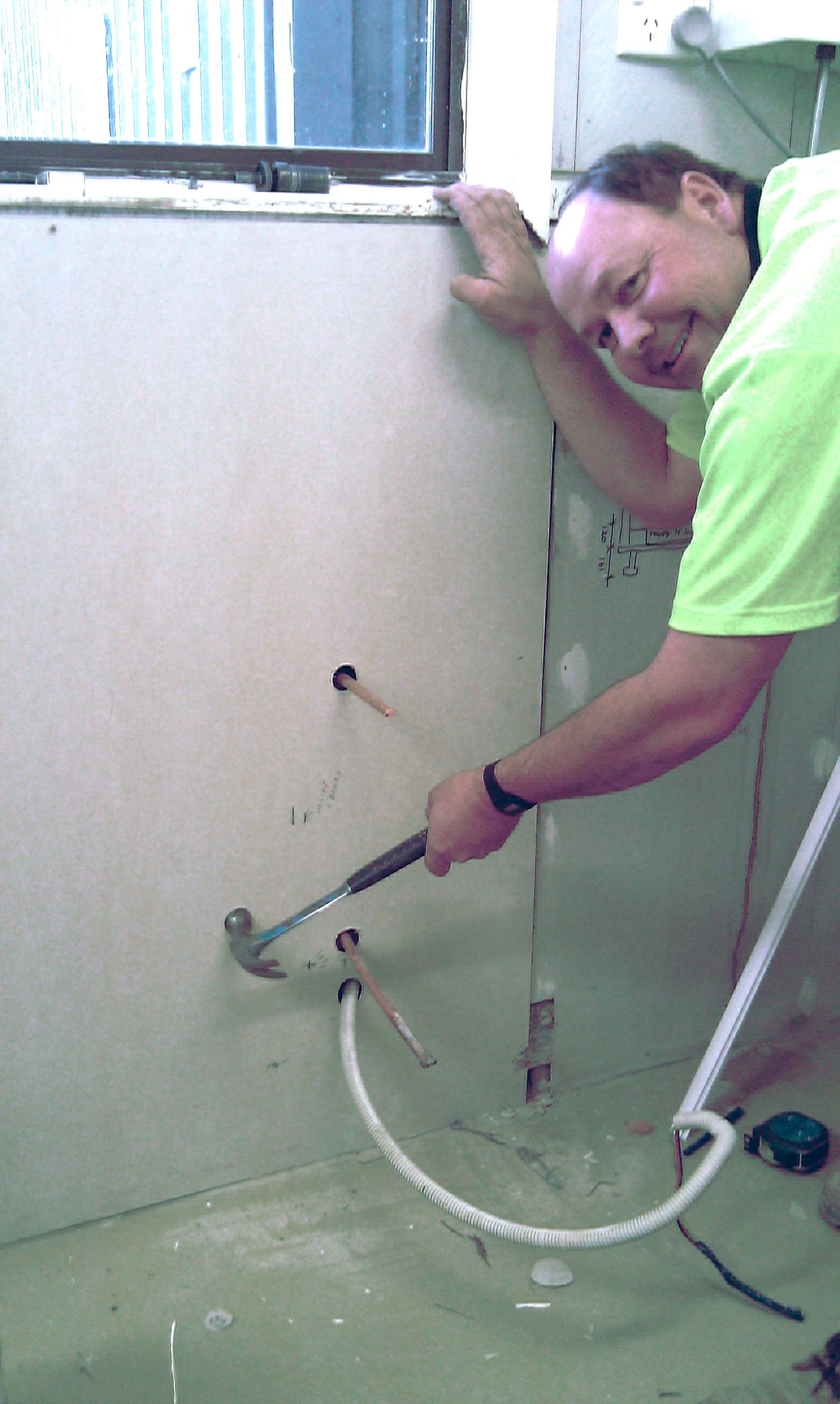
The Community Hall has been a veritable hive of activity of late, as Lofty and his band of merry men (and Joan) tackle the task of renovating the kitchen.
Status report from Lofty, photos by Peter Greenwood
Our first step was to purchase and assemble the kitchen cupboards. In the same fell swoop we bought a new sink and under bench oven. Then the wrecking and repairing began. My wife says ‘that a mess means progress’ but this was ridiculous. Out came the old collection of cupboards. The outside servery and east wall was dismantled. Ceiling lights and panels removed. The stove was disconnected and everything that was moveable was stripped out. After repairing the east wall and with a new servery window in place, the floor tiles were removed. Meanwhile on the roof Don removed the old ventilator (which was jammed with an underarm spray can) and repaired the leaks. Using a hired concrete grinder on the kitchen floor a slurry pond was created which finally cleared to reveal cleaned concrete. We had the mess so how about some progress?
Click on the photos
to enlarge them
 The original kitchen
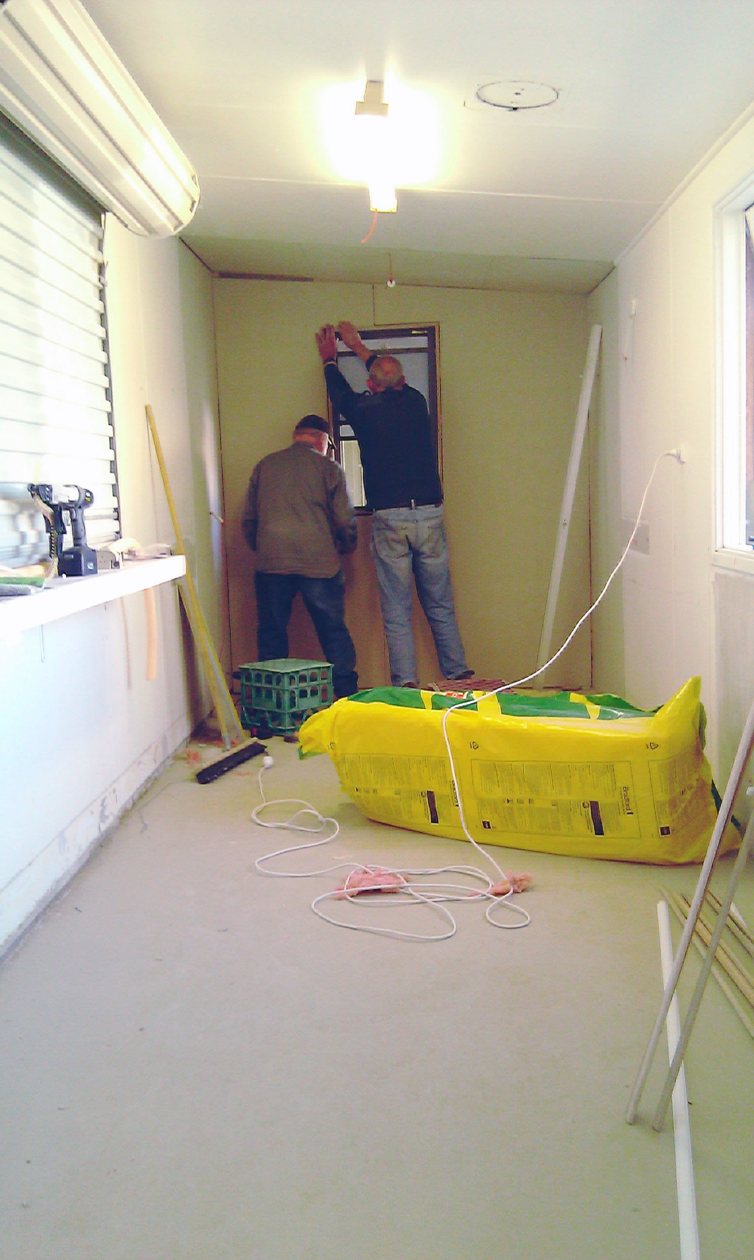 Lofty & Hank working on the 'extension'
 The mice had made themselves at home
 Don's precision holes
At this time we still have panels to repair and painting to do before the cupboard shells are installed and dressed. We will then have the stainless steel bench-top installed. The list of workers to date include: Peter Greenwood, Charlie Montesin, Ron Shepherd, Don Evans, Trent Abell, Tim Barter, Keith France and Ian Coillet. Joan has done a great job feeding and fuelling the workers. I also appear on the list as my position as ‘project officer’ ensures I can be blamed for any mistakes.
I include a special thanks to Steve Hughes of ‘The Feed Shed’ in Bungendore who has made an unsolicited gift of $200 to our project. We plan to purchase a ‘Feed Shed’ microwave oven.
29 August 2011
The attached photos show that considerable progress has been made. The only extra wrecking as listed last Whisper was the removal of the servery roller shutter and surrounding trim. We have now replaced and painted all wall and ceiling panels, painted the floor and installed the cupboard shells. The ceiling lights have been replaced and new power points fitted. These power points include one in Hall for the heater and one on the entry veranda.
 The floor gets a face lift
 We briefly entertained an alternative use for the new room...
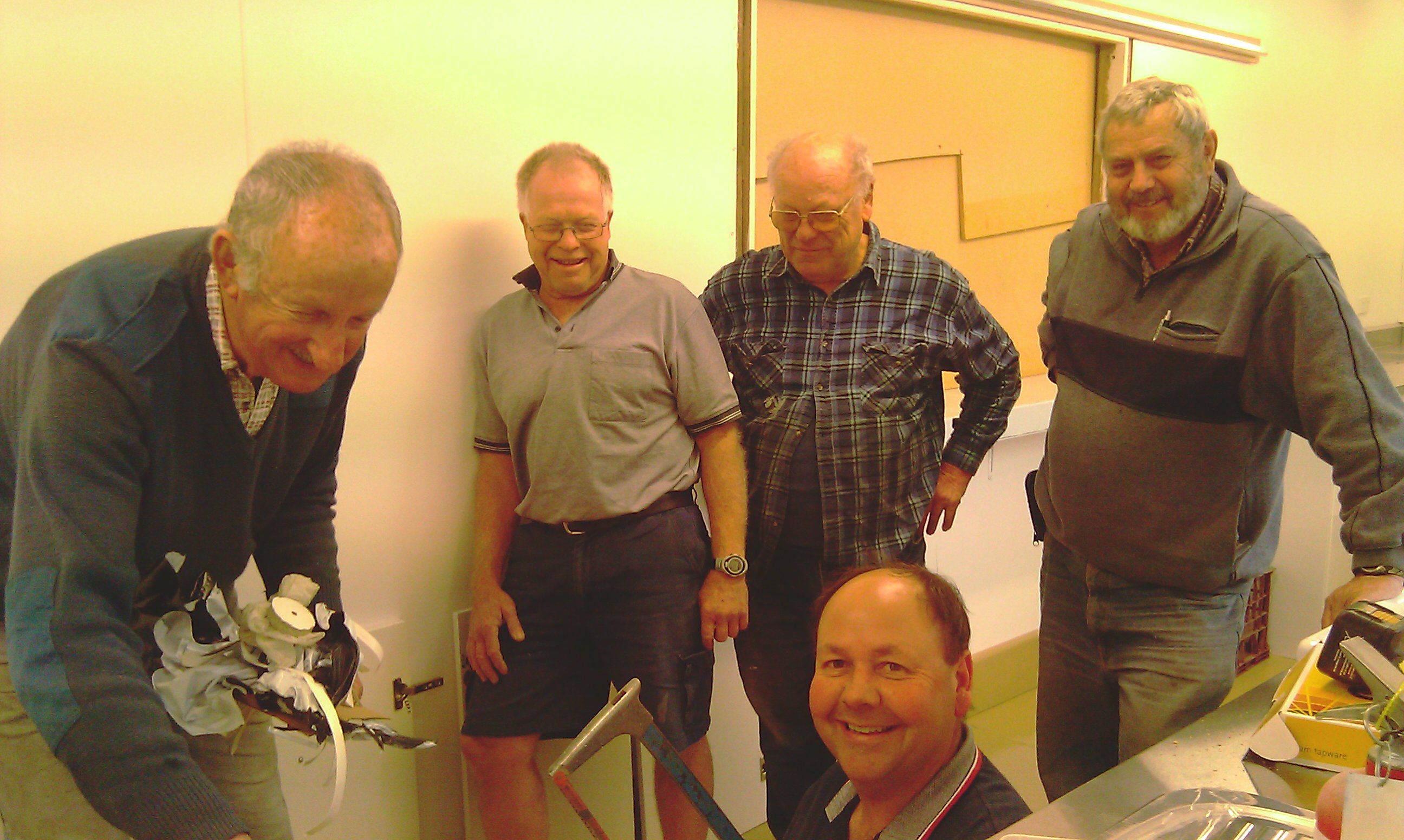 (Most of) The Team
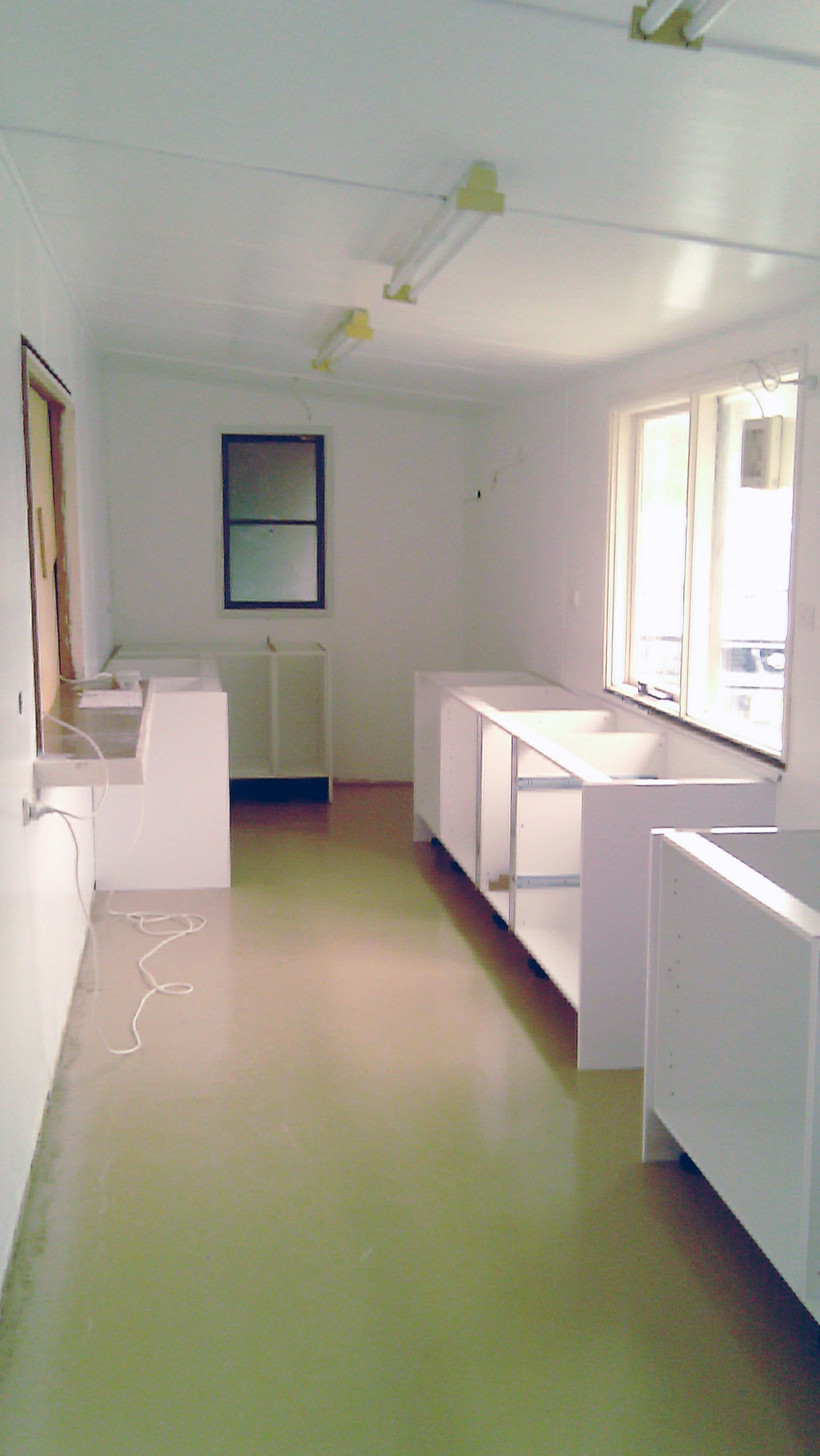 The cabinetry is installed
The stainless steel bench-tops and servery shelf were delivered last Monday, with the final installation of stainless steel fittings, and the doors and draws fitted to the cupboards today. Hank Berlee has joined the list of workers since he returned from Queensland and Councillor Pete Harrison has taken on the repair of plaster and the painting of doors and architraves.
 It's all looking pretty bright and breezy
 Those flash new stainless steel bench tops
 Cupboard doors fitted
 The new servery doors (at right)
Future work includes the fitting of sliding doors in the servery window, the manufacture and fitting of cupboards in the entry plus a mop drying rack outside. Finally we also plan to renew the leaking gutter along the south side of the Hall. And that I hope will be the finish of this project. Check for the final chapter in the coming weeks!
top26 October 2011
Proposed Mobile Phone Tower for Wamboin/Bywong
DA.2011.329 (formerly DA.2011.310) 194 Denley Drive
After the brief Wamboin Community Association General Meeting on 20th September, a Telstra team led by Rob Cusack, Telstra Program Delivery, addressed those present. Rob took numerous questions and comments over at least an hour from the audience of 40+ residents of Wamboin and Bywong. He was assisted by Liz Easton of Aurecon (town planner), and two local Telstra Customer & Commercial Service representatives, Dawn Goodburn and Kelly Lolesio.
The audience's questions covered a wide range of concerns, including the coverage to be expected, the levels of radiation to be expected, the community consultation opportunities, the reasons for not proceeding at the Poppet Road and Milpost Hill sites, the sorts of modelling that were carried out and the expected life of the proposed tower.
The proposed site is on the property at 194 Denley Drive, Wamboin. This site is now Telstra's preferred site because it best meets the variety of appropriate criteria, including coverage, a landholder willing to offer the site, environmental considerations and access for construction and maintenance.
The tower receives and transmits wirelessly to residents' phones and other devices. It simultaneously communicates with the broader Telstra network, probably through microwave to the tower at Goorooyaroo, nearer to Sutton.
The relevant Development Application has now been submitted to Palerang Council. The DA process usually takes at least three months. Community reaction to the DA is invited. After this process, if and when the possibly revised DA is approved by Council, construction usually takes about six weeks.
The photos, charts and maps relating to the proposed tower, which appear below, were created and supplied by Telstra for the purpose of providing information to Bywong and Wamboin residents.
The following points are of note:
- The demand from our customers for Telstra mobile services is approximately doubling every calendar year
- This customer demand is led by a growing appetite for smart phones and wireless broadband devices
- Existing network base stations can cater for a finite amount of mobile traffic
- The exponential increase in demand for this finite capacity is creating the need for additional infrastructure
- This is particularly evident in areas such as Wamboin and Bywong where existing coverage levels were low
- A new base station is required to meet this growing customer demand for mobile services in Wamboin and Bywong
- Telstra has considered a large number of potential site locations in the Wamboin and Bywong taking into account technical, design, town planning and ownership constraints
- The only suitable location is considered to be at 194 Denley Drive, Wamboin
- This location offers a number of favourable site conditions including existing mature vegetation that will visually screen much of the facility and sufficient elevation for the technical requirements of the equipment to be satisfied
- The maximum level of radio signal (EME) emitted by the site will be a small fraction of the permissible levels. Predicted levels are 0.11% of the Australian Standard which is 909 times less than permissible levels.
- Telstra met with members of the Wamboin and Bywong communities at the Wamboin Community Association meeting on Tuesday 20th September
- Telstra plans to submit the Development Application for this project on Tuesday 27th September
- Community members are encouraged to make written submissions to Council during the advertising period for the proposal. Dates for this period will be announced by Palerang Council in due course
Anypone interested in obtaining additional information regarding the proposal is invited to contact:
Liz Easton
Environmental Planner
Aurecon
Ph: +61 2 9465 5414
Fax: +61 2 9465 5598
Mob: +61 406 096 756
Email: eastone@ap.aurecongroup.com
PO Box 538 Neutral Bay
NSW 2089
http://www.aurecongroup.com
Sources of information on general issues regarding mobile base station deployment and public health and safety include:
Site Views
The following are actual "Before" (left) and projected "After" (right) photos of the proposed mobile phone tower, created and supplied by Telstra. Click on the individual images to enlarge them (the tower is the skinny stalk on the skyline).
Site Plans
Location Map
The map below illustrates the existing Telstra mobile phone towers (yellow 'pins') that already service areas in and around Wamboin and Bywong, and the proposed new site on Denley Drive (red pin). The polygon represents the general area where existing coverage would be improved by the proposed new tower.
Coverage Map
The green areas indicate where it is predicted that the new tower will provide high quality, in building, broadband coverage. There may be coverage improvements of a lesser degree to areas that are not shaded but it is not possible to further qualify these improvements in this format.
top1 September 2011 - 31 March 2012
2011/2012 Fire Season Brought Forward
The Wamboin Volunteer Rural Fire Brigade wish to advise local residents that the 2011 / 2012 fire season for the Lake George Zone (LGZ) has been brought forward - to begin on the 1st of September 2011. The LGZ includes all localities in the brigade's area i.e. Bywong, Sutton (south of the Federal Highway) and Wamboin.
Unusually high fuel loads in the region and the expected dry conditions over the coming months are the main factors for the decision to bring the start of the fire season forward 1 month.
One of the impacts of this decision is that from the 1st of September lighting of open fires or hazard reduction activities undertaken in the region without a permit is in violation of the law. "Burning off" or any lighting of open fires will require a permit from the Wamboin Brigade. Please phone the brigade Captain for advice on obtaining a Permit on 0409 991 340
Residents should be aware of the inherent risk this coming fire season poses, and remind all to follow fire safe practices when working with equipment and machinery outside in the region.
The Wamboin Brigade holds regular attendance on Wamboin market days for anyone wishing to enquire about fire safety. A number of specialised and focussed information sessions are expected to be held at various times during the fire season to keep local residents informed. The first of these sessions is a community-wide bush and grass fire awareness/preparation information session on 17th September (read more).
All residents should have a fire survival plan to protect their family, friends, animals and property. The Wamboin Brigade provides a range of targetted fire safety advice on this website, and links to relevant pages on the NSW RFS Website
For more information please contact the Captain or Secretary of the Wamboin Brigade.
Firefighting Pump Selection Guide
The brigade has been contacted on a number of occasions to provide advice regarding purchasing firefighting pumps. In response the brigade now provides this advice online for the benefit of all residents - you should review your own personal circumstances against the checklist criteria before purchasing equipment. Read More
Report Smoke and Fire Sightings
To report fires or smoke sightings please ring Triple Zero (000)
PREPARE. ACT. SURVIVE.
John Taubman
Secretary
Wamboin Volunteer Rural Fire Brigade
Land for Wildlife

In the August Whisper I wrote asking for expressions of interest for people to come along to the Wamboin Community Hall on Saturday 30 October 2010 to hear John Asquith (CEO of the NSW scheme) speak about the Land for Wildlife scheme. Unfortunately few people have shown an interest so far. You can find out more about the Land for Wildlife program at www.cen.org.au/landforwildlife or give me a call.
As mentioned last month, the Land for Wildlife scheme encourages property owners to commit to managing all or part of their land in an environmentally friendly way. The program is free to join and is not legally binding. The minimum size of land to register is half a hectare of native bush land. Over time the scheme not only provides refuges for wildlife, but allows wildlife corridors to be created where Land for Wildlife areas match up. It also gives us encouragement to look after our wildlife and enjoy having it around.
If you are interested in meeting John Asquith on 31 October could you get in touch with me by 22 September 2010 please? I can then decide whether to go ahead with the meeting. If there are only a few people, then we may not need the hall as a meeting place.
Cheers!
Philip Machin
6238 3717
machin4@bigpond.com
14 February 2010
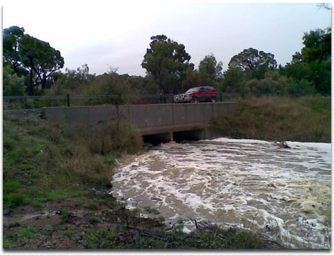
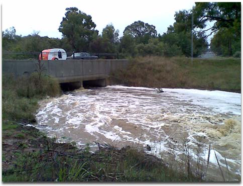
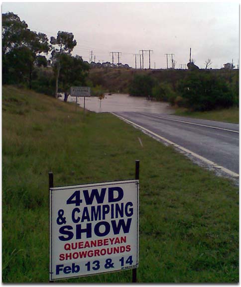
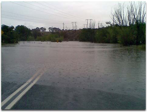
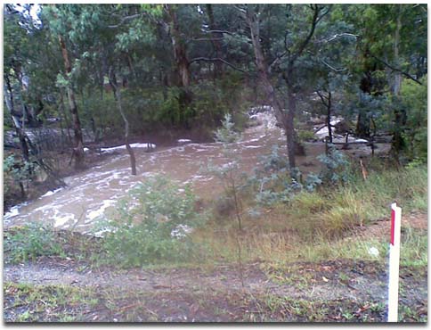
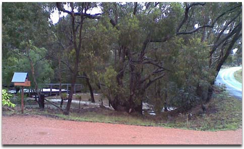
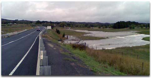
It Never Rains, But it Pours!
Wamboin received around 100 millimeters of rain on Valentine's Day weekend. These photos show some of the area's waterways between 2:00 pm and 3:30 pm Sunday, Valentine's Day.
The major culverts on Sutton Road about halfway between Pialligo Avenue and Norton Road. These culverts are designed to withstand a 100 year flood.
The Oaks Estate crossing, approached from the north.
The creek that Jo Walker sometimes mentions in her Whisper articles. It crosses under Norton Road about 100 metres east of Fernloff Road.
The Yass River from its crossing under Norton Road a few hundred meters west of Weeroona Drive.

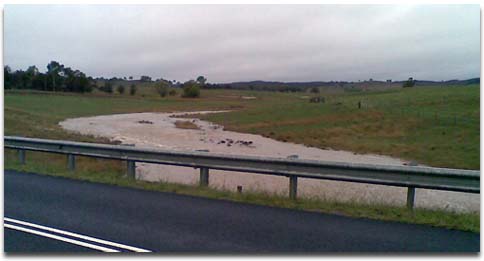
Reedy Creek crossing under Bungendore Road between Macs Reef Road and Norton Road.
The Yass River from the bridge just south of the Federal Highway.

top
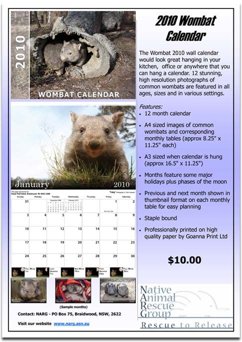
January 2010
2010 Wombat Calendar
Local contact - Philip Machin 6238 3717
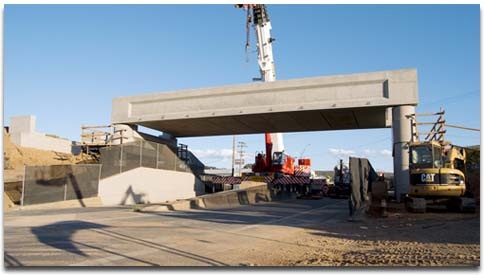
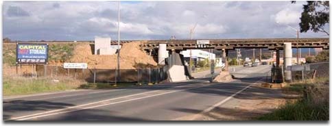
27 October 2009
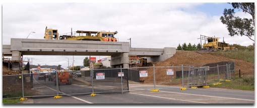
Road Open
The essential bridge work is now complete, although the tamping machine is still working on the track. While Yass Road is again open to traffic, there will be ongoing roadworks in the area for several days while landscaping work is completed.
14:42
26 October 2009
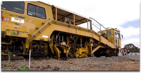
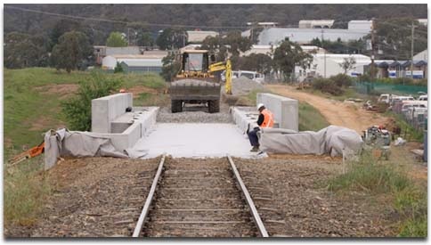
On Track
The track has been laid and is currently being leveled with the aid of specialist railway machinery. The larger piece of equipment in the photos is a tamping machine. Once the track has been laid down, this machine measures the level of the track at each sleeper. Using hydraulic rams and tamping bars, it moves the track up or down, as required, tamping the track ballast (rock foundation material) to the required level.
12:26
The smaller machine is its constant companion, a track sweeper, that follows behind clearing the excess material away from the track.
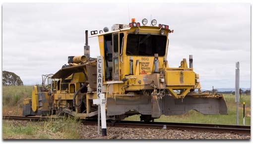
12:29
12:33
Everything is on track for the bridgework to be completed and for Yass Road to be reopen this evening.
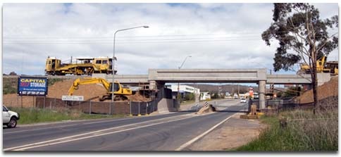
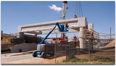
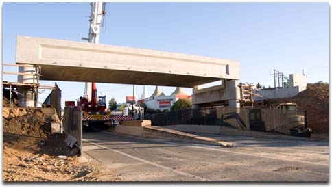
top25 October 2009
Heavy Lifting Complete
The bridge structure is now in place, and it's now just a matter of finishing off the fiddly bits. Oh, and putting the railway line back in place...
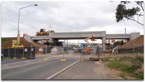
12:55
12:59
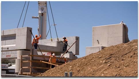
24 October 2009
Like Meccano
The new Yass Road railway bridge is taking shape, as works continue apace. It's just like Meccano! The main spanning beams are set, and the cross-members are being moved into place.
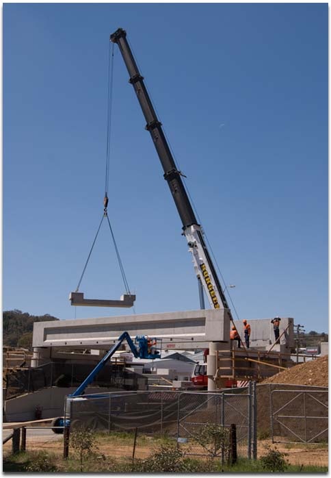
12:15
12:16
12:22
12:30
18:30
18:34
18:35
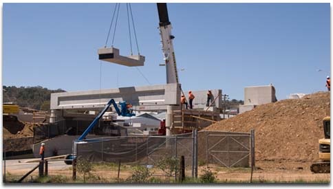
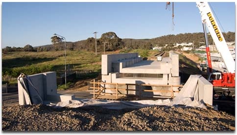
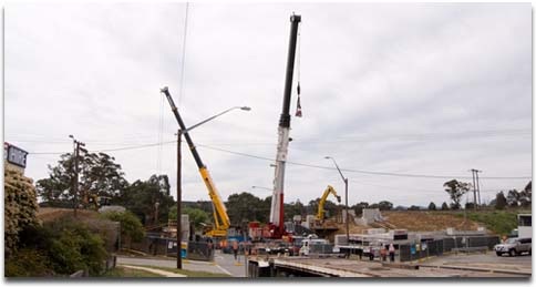
23 October 2009
Works Begin on Yass Road Railway Bridge
Works on the Yass Road railway bridge upgrade began at 6.00 am this morning (Friday). By early afternoon, the old bridge had been fully dismantled and cranes were positioned to begin moving the new, precast concrete beams into place. Check back over the weekend for more photos of the construction process.
October 2009
Closure of Yass Road
To allow for the demolition of the existing bridge and the construction of a new bridge, the section of Yass Road between Sutton Road and the entrance to the Airport International Motel will be closed to all traffic. The closure will be in place from 6.00 am on Friday 23rd October 2009 until 6.00 pm on Monday 26th October 2009.
There will be advanced warning signs placed at numerous locations to advise the public of this event and the detours available.
Pialligo Ave traffic to Queanbeyan & Kings Highway will be detoured via Oaks Estate Rd, Railway St to Uriarra Rd.
Kings Highway traffic to Pialligo Ave & Sutton Rd will be detoured via Canberra Ave, Kendall Ace North, Uriarra Rd, Railway St & Oaks Estate Rd
Canberra Ave traffic to Sutton Rd will be detoured via Norse Rd, Railway St and Oaks Estate Rd.
Lanyon Dr traffic will be detoured via Canberra Ave, Kendall Ave North, Uriarra Rd, Railway St & Oaks Estate Rd.
For further information, contact:
David Logg
Operations Supervisor
Traffic Technologies
Ph: 02 6299 7922
Fax: 02 6299 7977
Mobile: 0448 810 174
Email: david.logg@trafficltd.com.au
17 November 2009
Library Development Grant
Following an application made last year, Palerang Council has received a Library Development Grant of $11,874, to be used to augment library holdings of titles relating to "Non-Fiction Reading for Men and Boys".
As the grant application was formally supported by the WCA, Council is seeking our input in selecting titles to add to the Bungendore and Braidwood libraries.
If you have any suggestions for subject areas or topics that you would like to see, or that you think would be of value in the present context, please pass them on to John van der Straaten or Pete Harrison (see Contact Us), or email them to the WCA secretary at secretary@wamboincommunity.asn.au by December 13, 2009.
topHow to publish newsworthy articles to this site
If you have a news item worthy of local interest the please send an email with the relevant details to the WCA Webmaster at webmaster@wamboincommunity.asn.au